2017
We
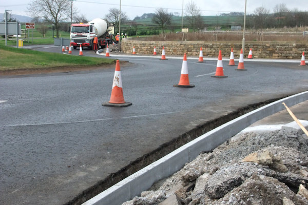
started 2017 with Yorkshire Water finishing off their work to upgrade the
town's West side water supply while upgrades to the gas network in town were
underway in the area of Brunswick Street & Bagdale, upgrading aging metal
pipes to plastic ones. The last phase of work to the water pipes was in the
West Cliff area with work around Crescent Avenue complete by early February.
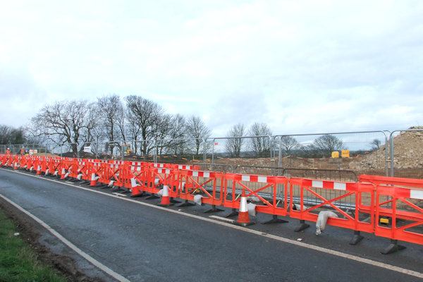
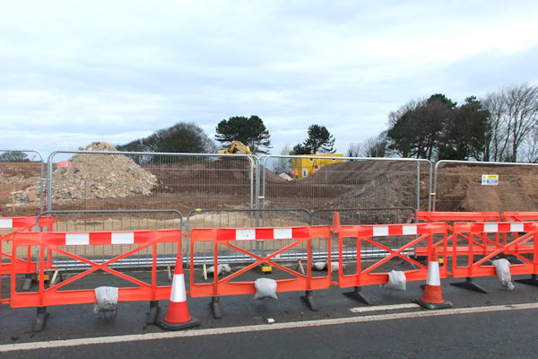
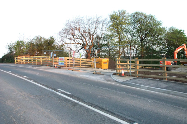
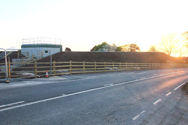
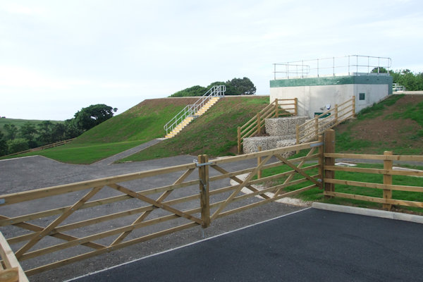
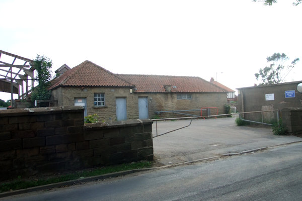
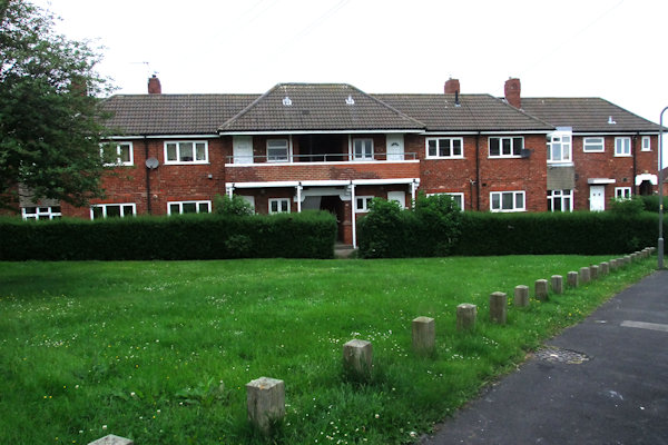
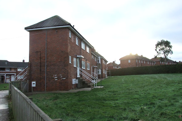
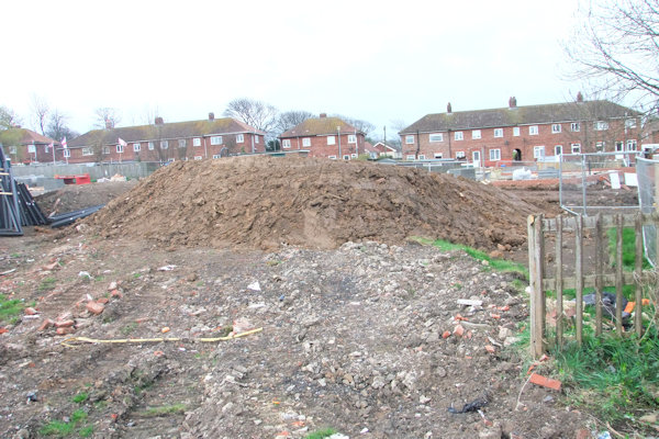
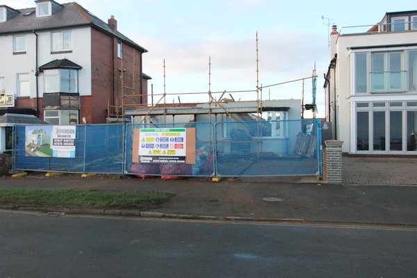
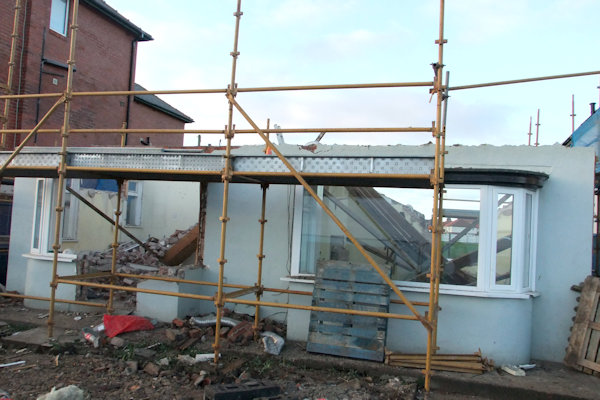
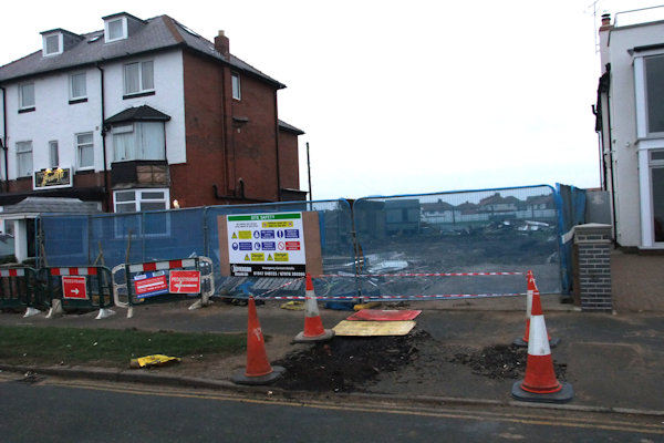
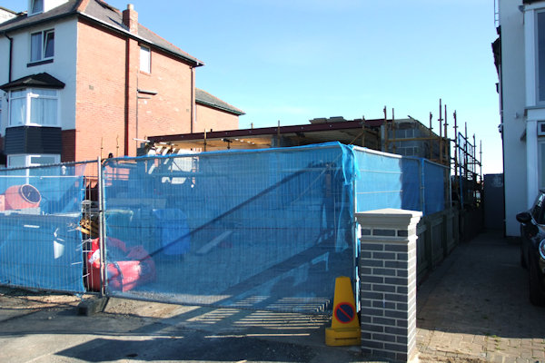
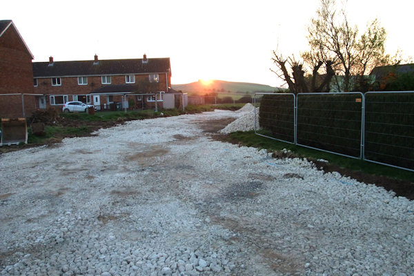
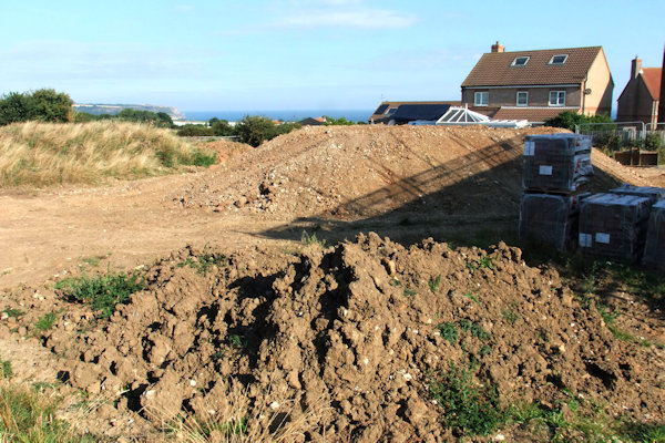
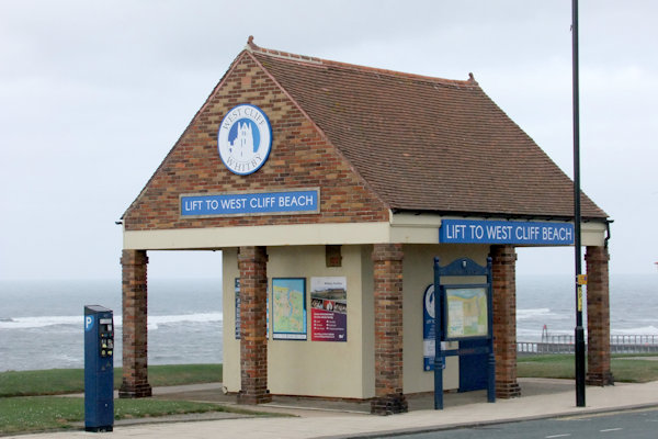
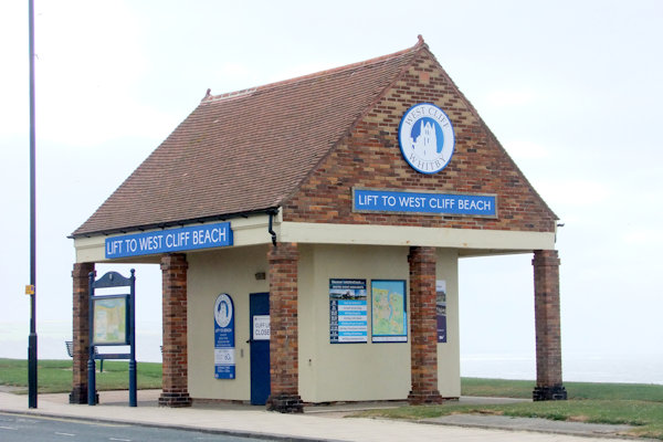
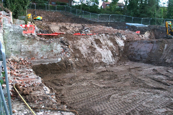
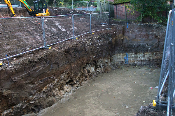
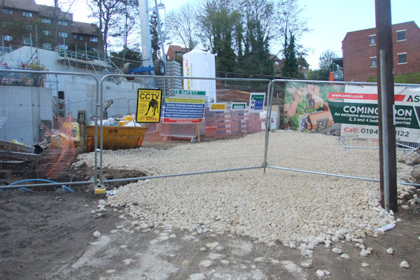
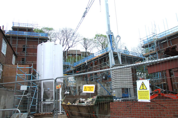
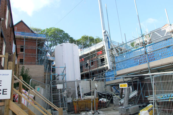
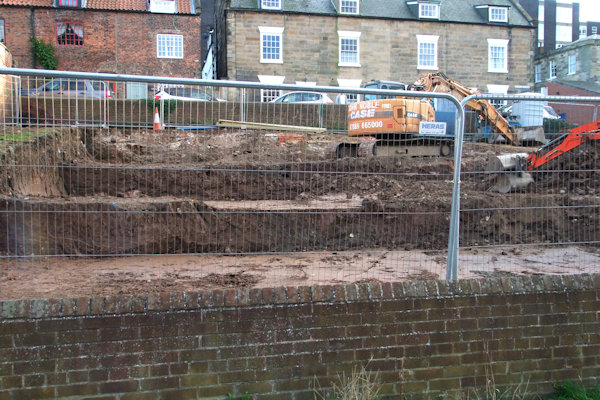
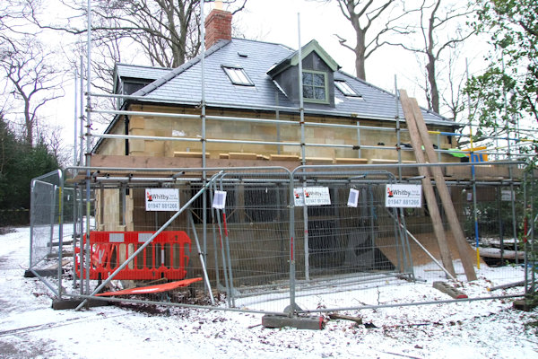
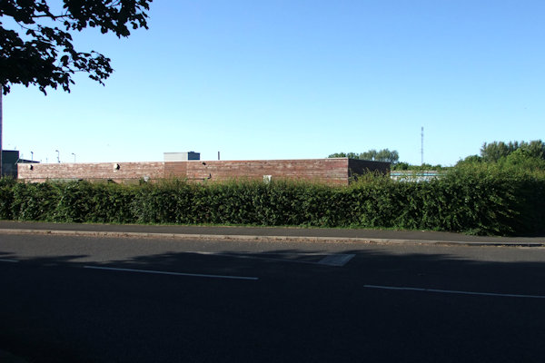
The area of
The area was levelled and a concrete wall was erected in May 2017 which would
enclose the reservoir. In November 2017, work was on-going to screen the top of
the reservoir which was finished with light-coloured pebbles so it blended in
with its surroundings.
Above left: The gas works at the
bottom of
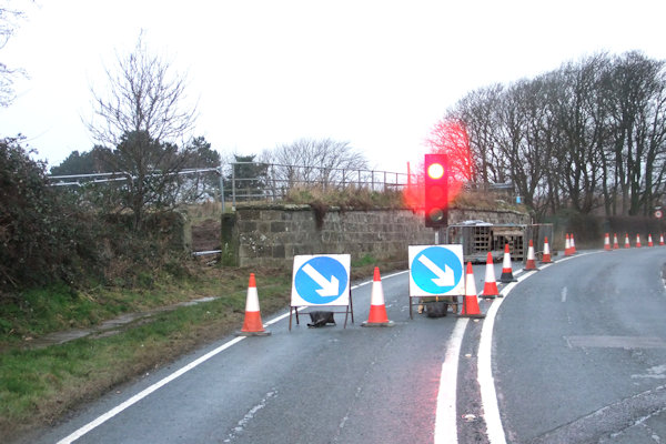
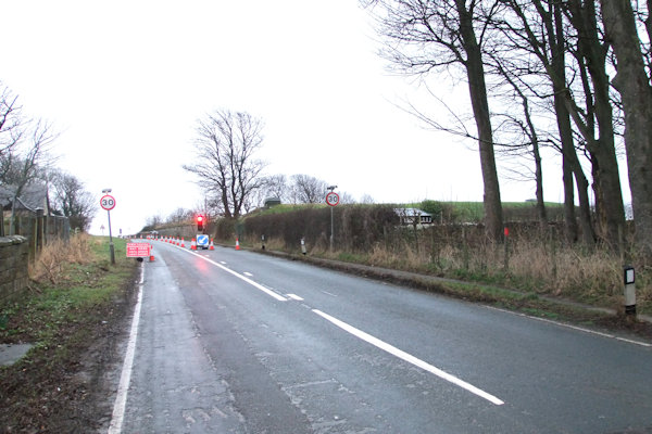
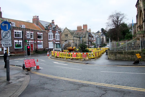
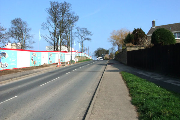
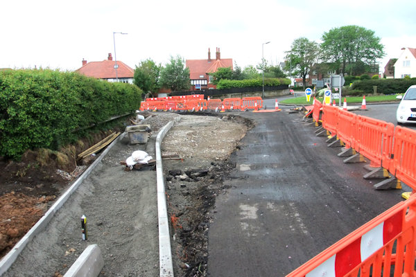
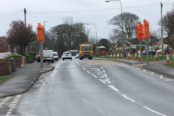
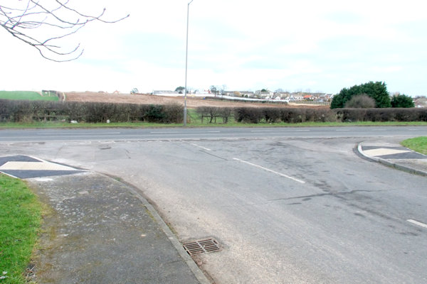
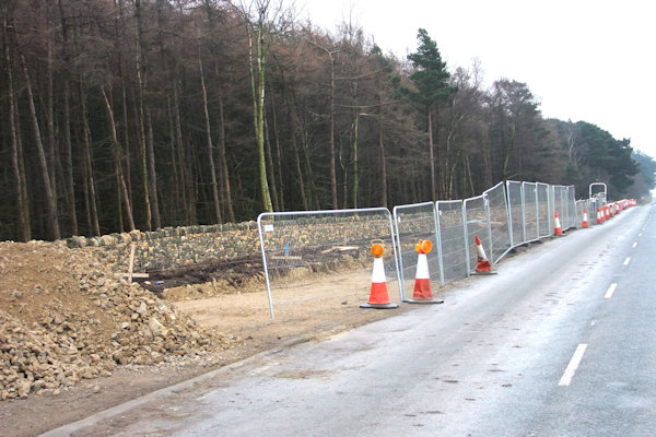
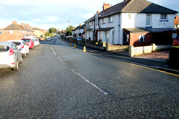
Above from left: The new 40mph speed
limit from Cross Butts Roundabout to the extension of the 30mph limit; The
entrance to the extended 30mph limit at the top of Castle Road near Ewe Cote;
The site of the works behind the retaining wall about to be demolished; Looking
up Castle Road towards the site on the right

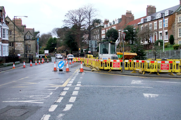
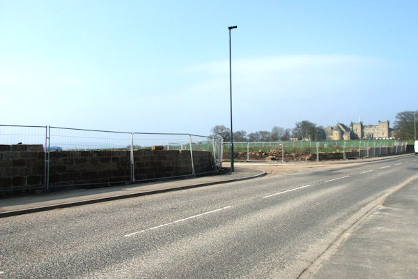
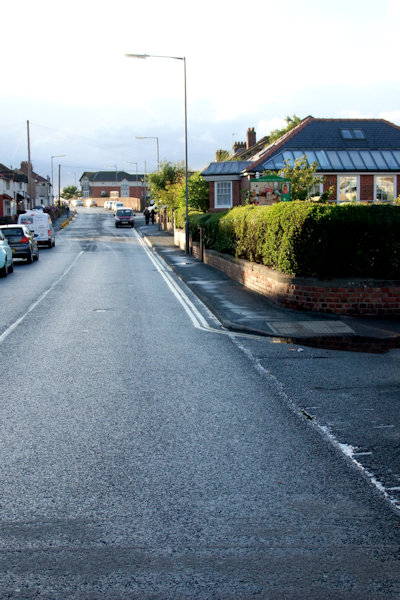
Above left: The site entrance looking
East; Right: Looking up
Above from left: Approaching the site
from


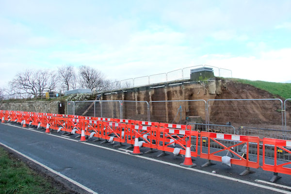
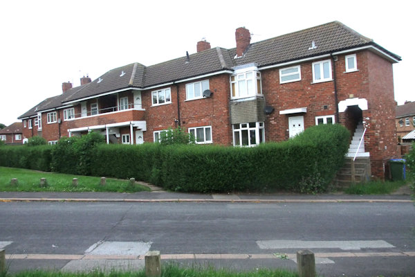
Above left: The site looking North; Left centre: The concrete wall being erected; Right centre & Right: Exactly 1 month later - more progress on the perimeter wall
Above from left: Perimeter wall coming along nicely; Cover going on

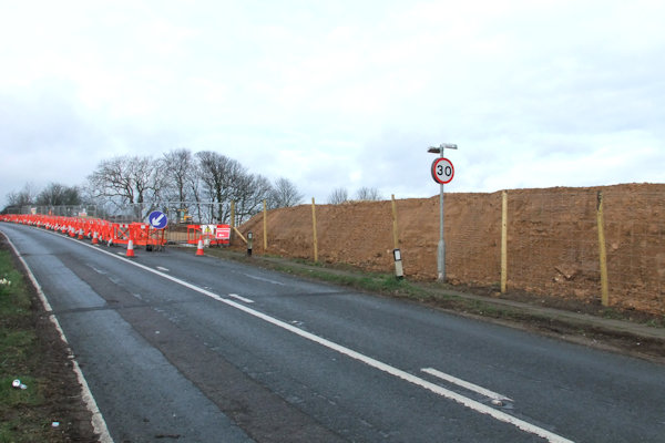
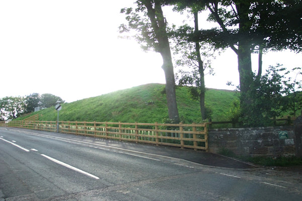
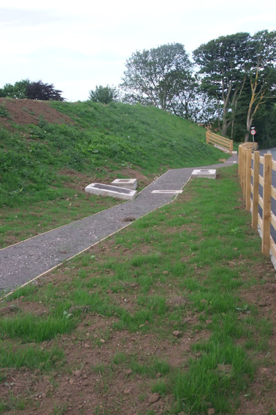
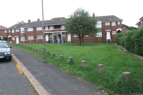
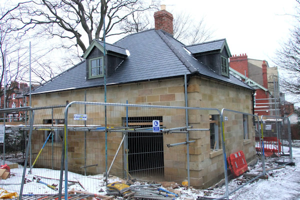
Above from left: The reservoir with
pebble screening on top; New footpath beside the site on
Above from left: The site of the
reservoir looking very much finished looking up
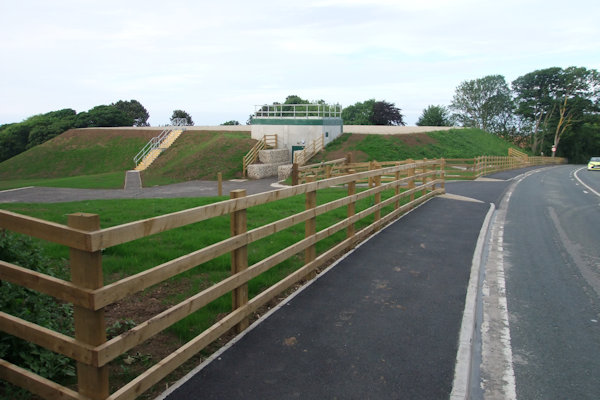
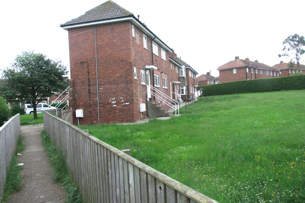
Above from left: The site from the lower
part; The site from the higher part showing the cover on top of the reservoir;
The entrance gate to the site; Looking down the perimeter fence bordering
Castle Road showing the various access covers
From
9th January, Meadow fashion shop in
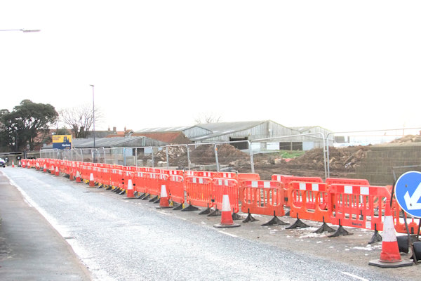
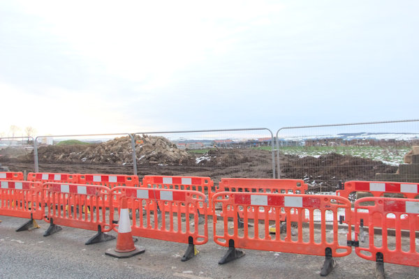
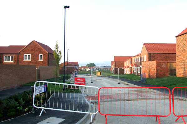
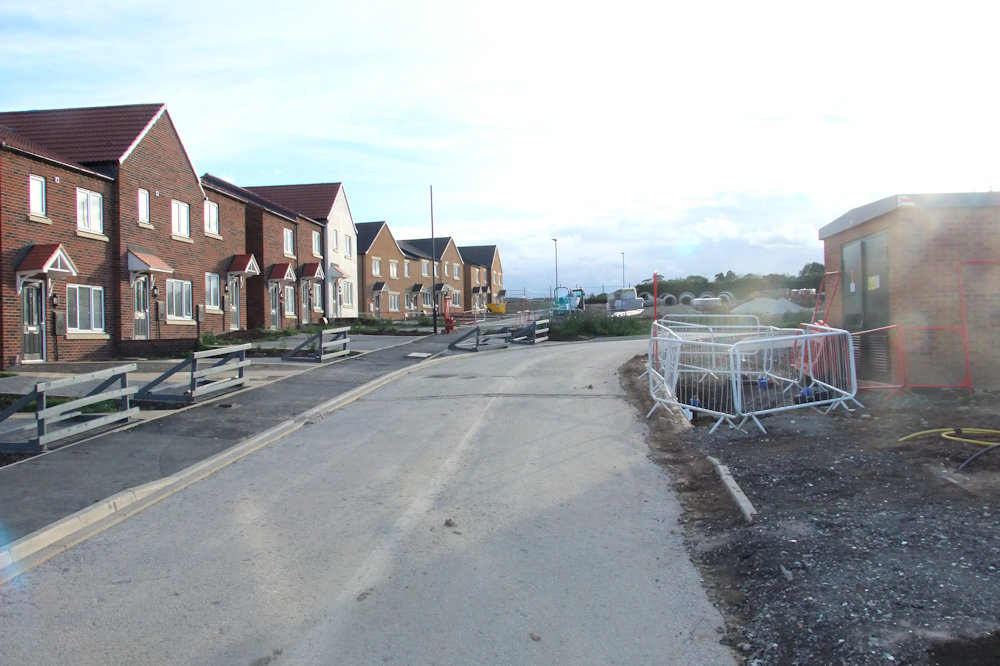
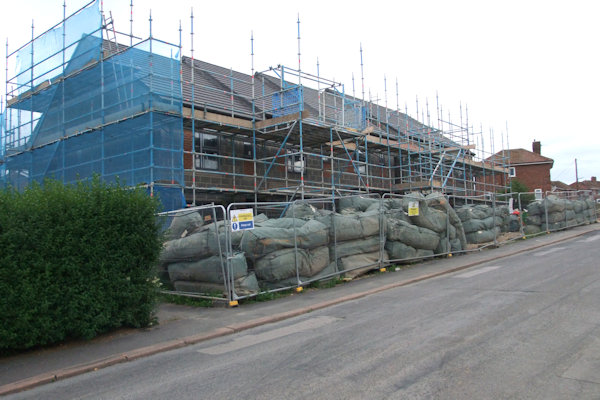
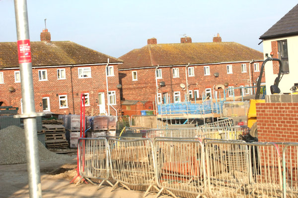
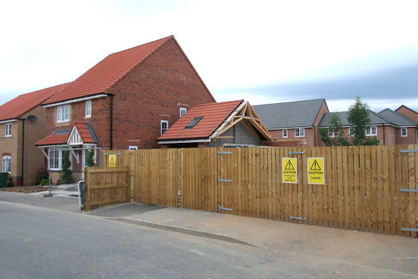
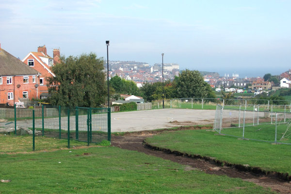
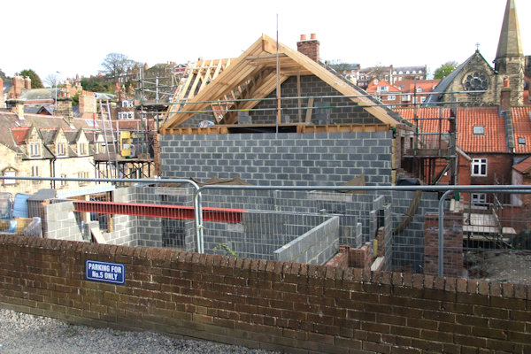
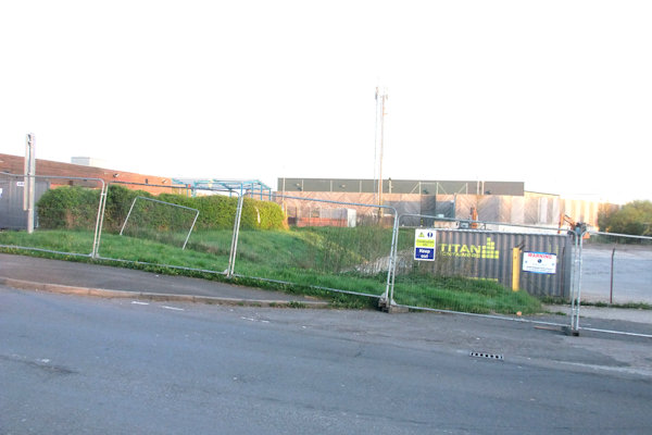
Work on erecting a solid fence all round the perimeter of a site which had been granted planning permission for housing on land belonging to The Order of the Holy Paraclete got underway in December 2016, taking more than a month to fully enclose the site. Previously to this a small fence existed on the site which was installed in 2010 replacing a gorse hedge.


Left: The new fence looking towards Four Lane Ends; Right: The old fence with the new fence framework behind


Above left to right: From opposite
the entrance to Sneaton Castle Farm towards Four Lane Ends; From Manor Close
towards Castle Road; From Manor Close towards Four Lane Ends
Below left & right: Looking up High Stakesby Road towards Castle Park; The fence
posts all round the edge of a field to the West of High Stakesby Road


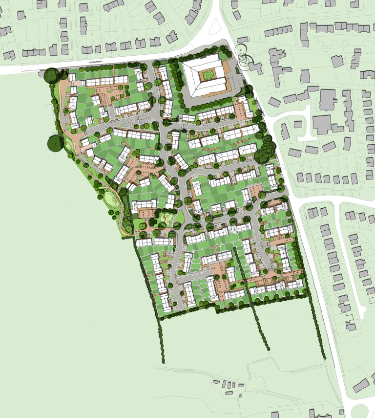
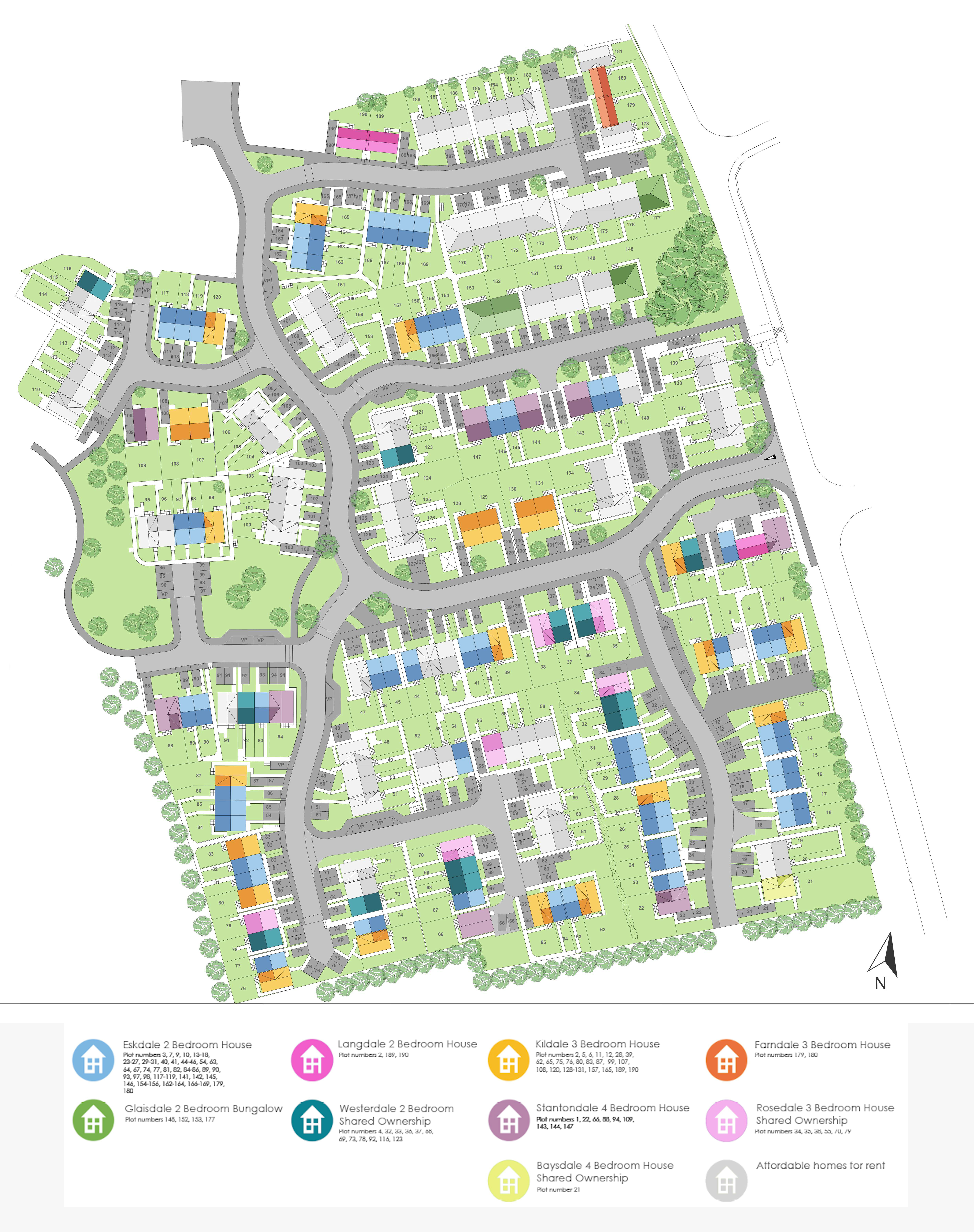
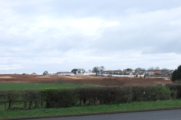
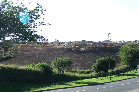
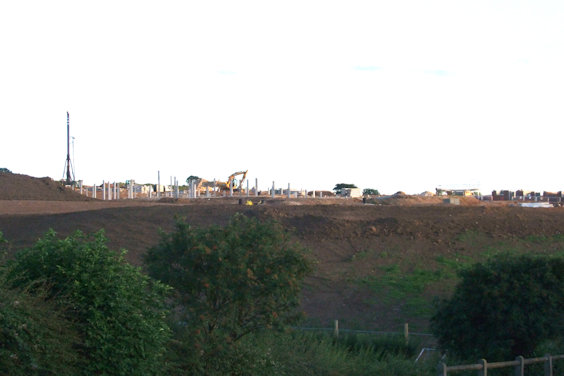
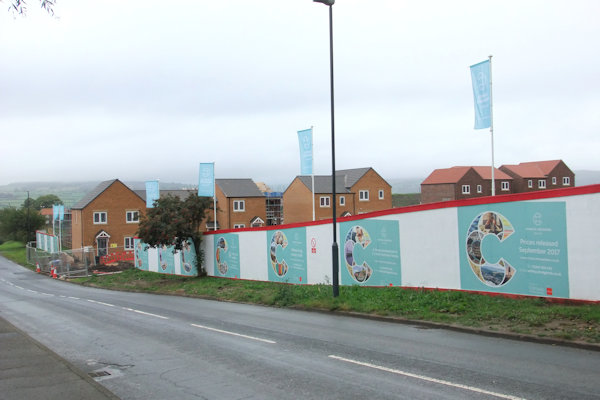
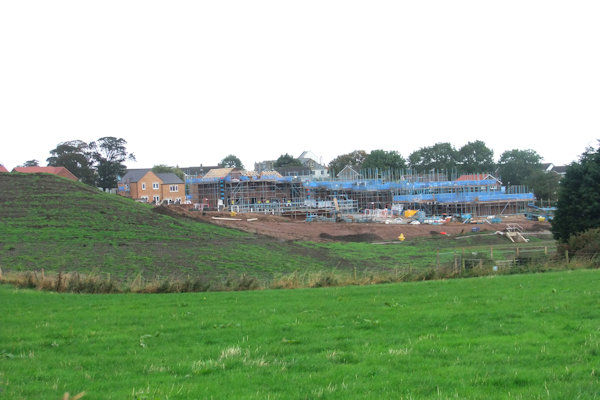
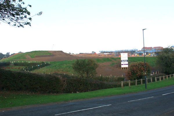
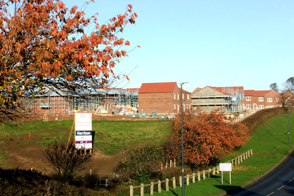
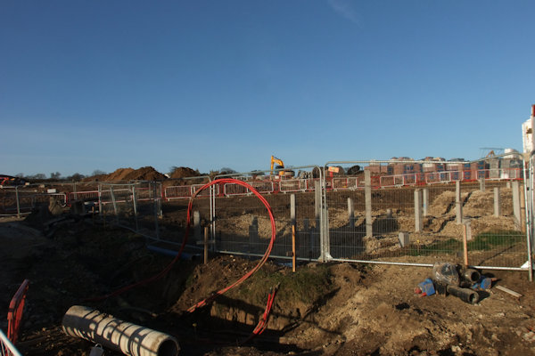
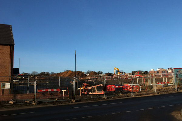
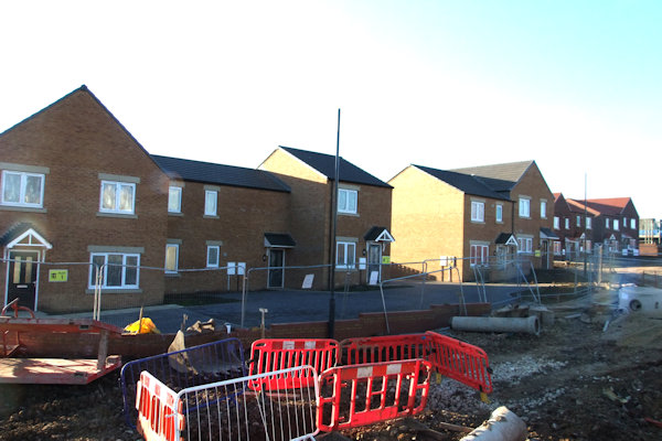
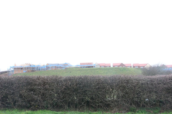
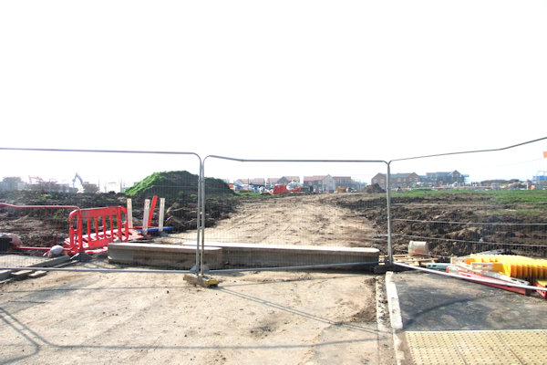
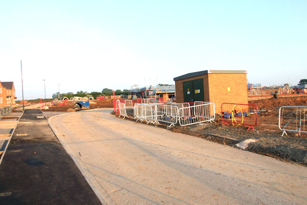
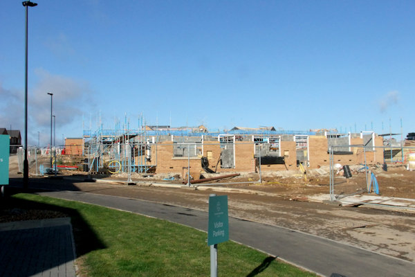
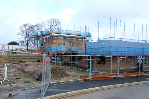
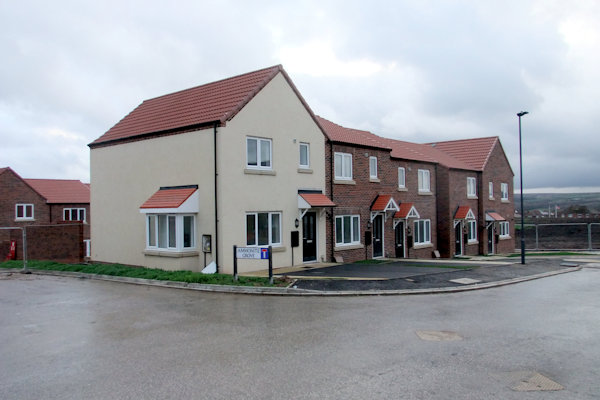
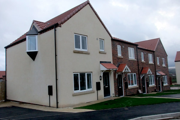
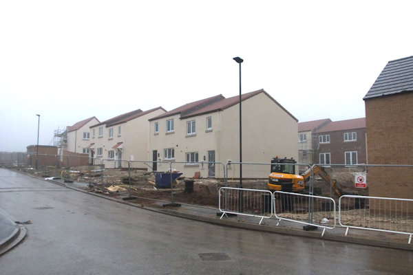
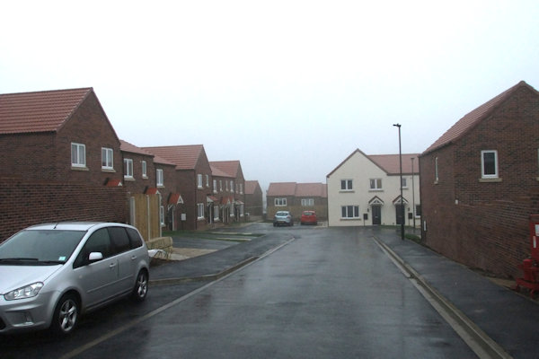
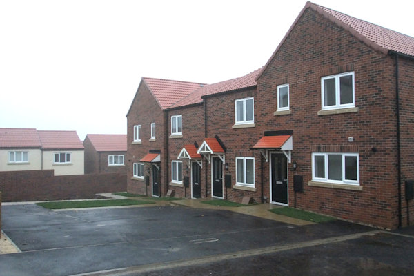
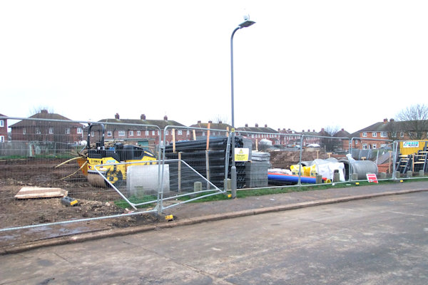
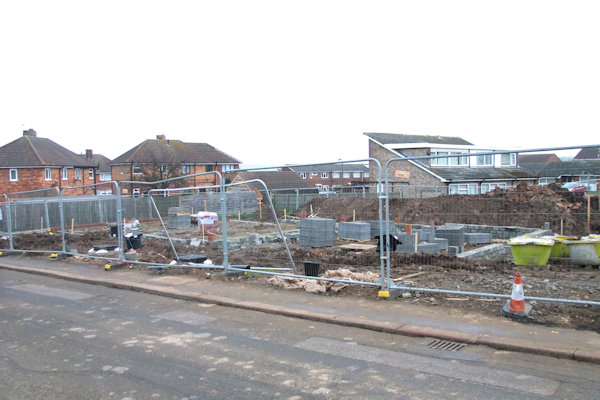
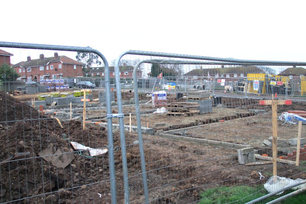
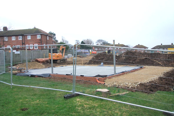
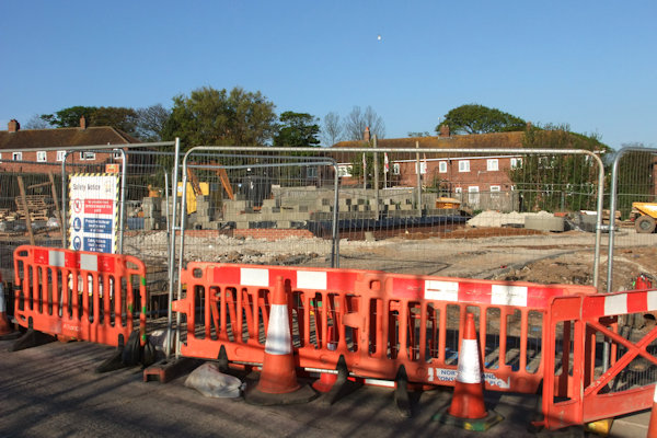
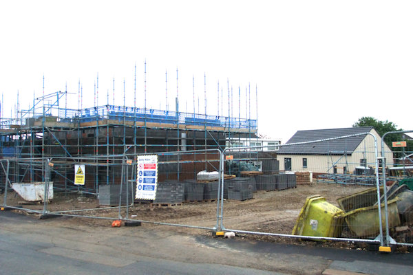
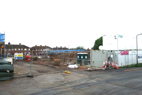
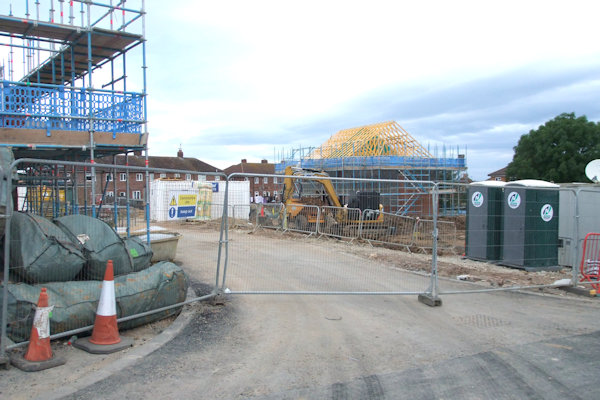
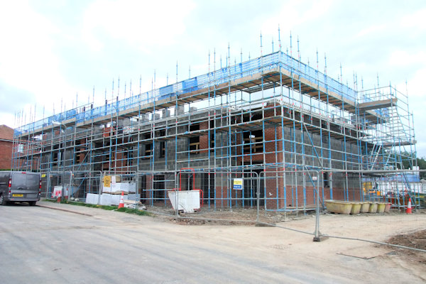
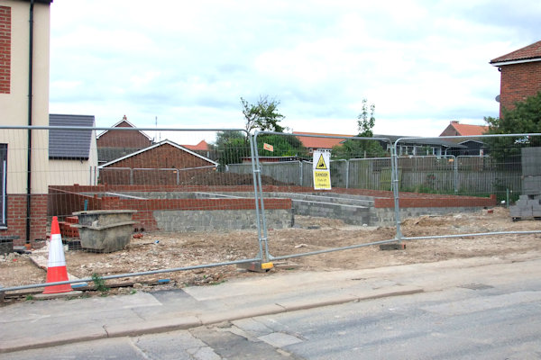
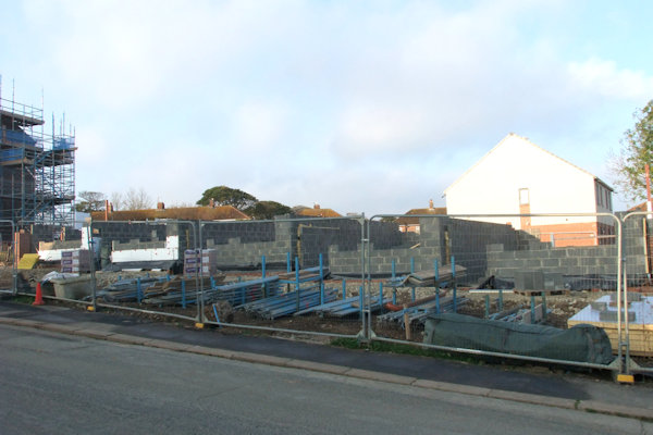
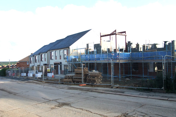
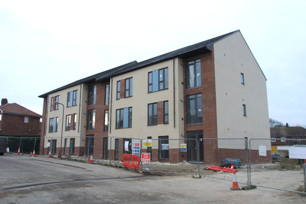
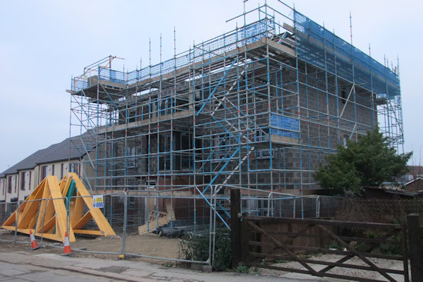
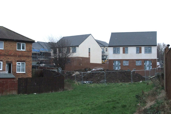
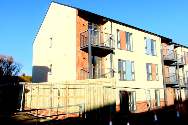
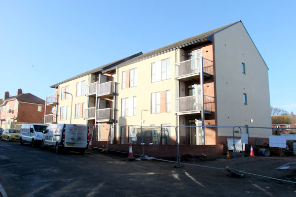
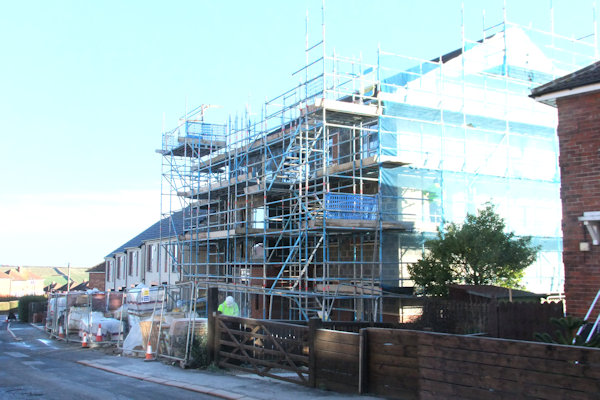
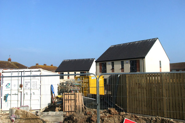
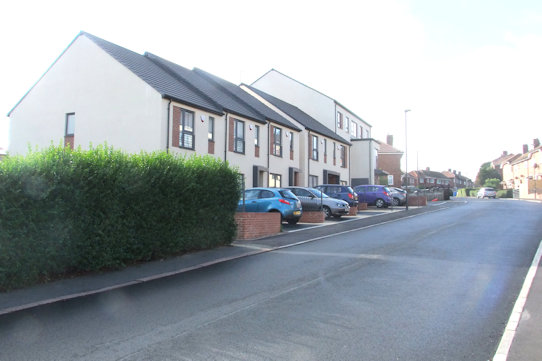
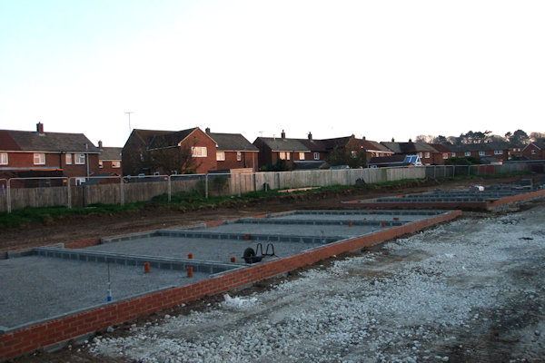
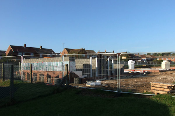
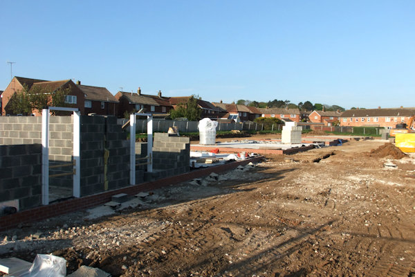
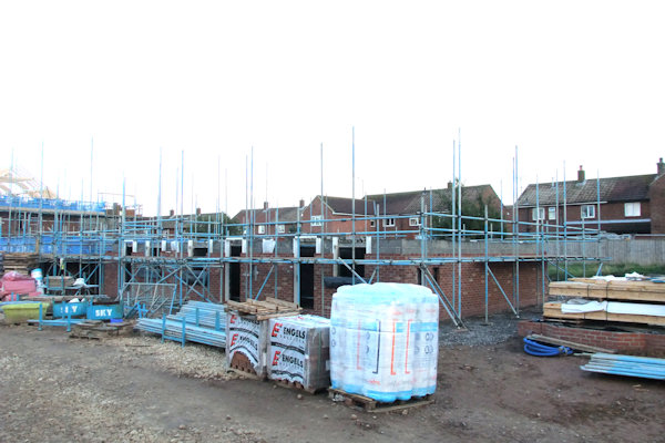
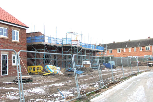
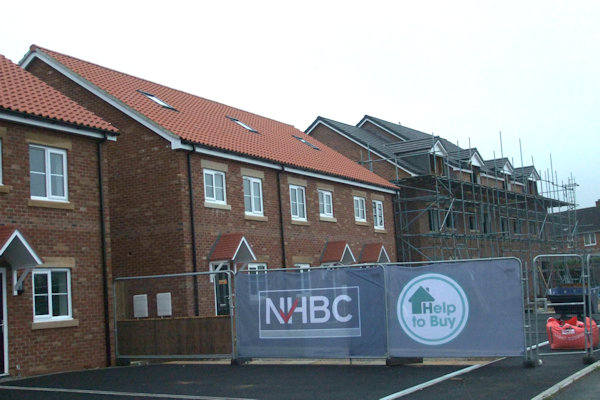
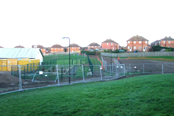
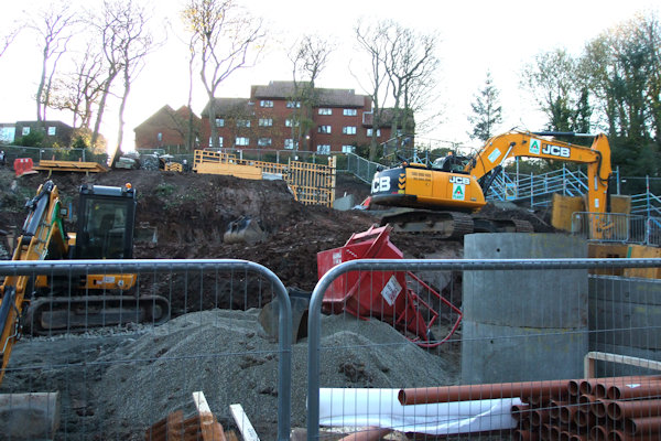
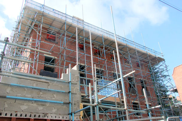
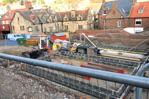
In late January, work lasting 3-years began as the fields were dug ready for a housing development to be built, for Tees Valley Housing by S-Harrison & Thirteen Group with the building company being Kier. The homes on the 16-acre site would be a mixture of properties for sale, shared ownership & rent & originally included plans for a 2-storey care home be built on the site to the North-east corner where farm buildings of Sneaton Castle Farm previously stood as well as 190 units of housing. The care home part of the plan was shelved and the area would be used instead for more housing. The new development 'Chancel Meadows' would feature a mixture of 2, 3 & 4 bedroom properties with a number of bungalows also to be built. 2 vehicular entrances were to be created to the site with an informal play area to the West of the development. The initial plans for the development and those of a little later differed. This was because the north-west end of the site was separated and was not part of Thirteen Group housing association but instead were private homes for sale through the estate agent Hendersons. The development was to be called Castle Fields after Sneaton Castle just to the West of this. Site plans are available below, to view in hi-res, click the relevant thumbnail. The site plan on the left was the original site plan for Chancel Meadows. The one in the centre was the revised site plan for Chancel Meadows and the one on the right is the site plan for Castle Fields.
.jpg)
Above left: Site Plan with


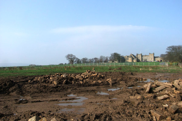
Above from left: From St. Andrew's Road
showing the site ready for development; The farm buildings near Castle Road
belonging to Sneaton Castle Farm;
The site from Guisborough Road; Work progressing towards Sneaton Castle Farm
The
first bricks were laid in early June as work on the first houses was started
near to the junction with

Above Left & Left centre - 17th
June: First houses going up near to the junction with
Above: The view of the site from
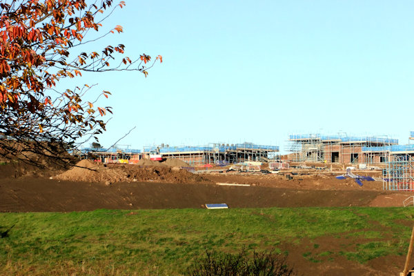
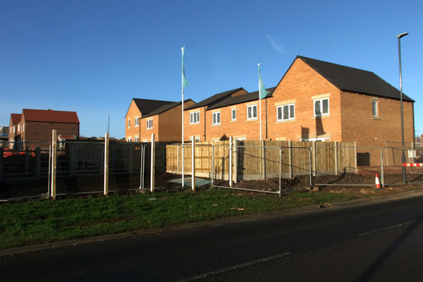
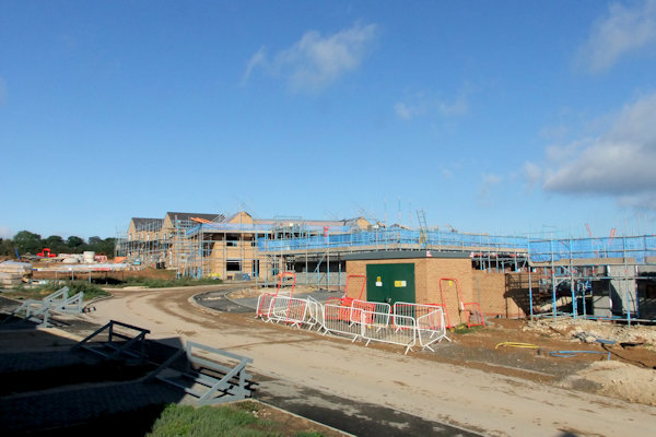
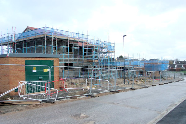
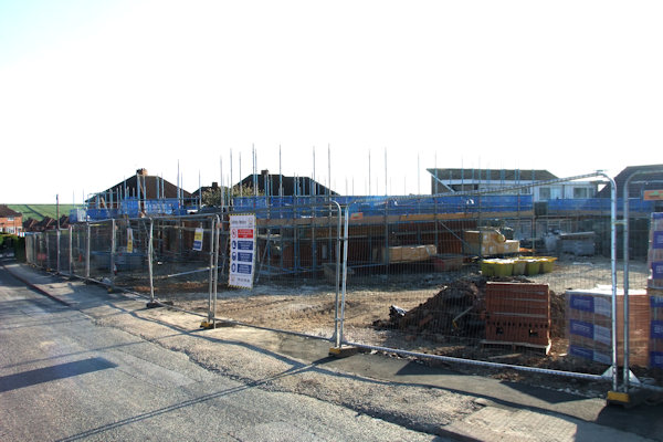
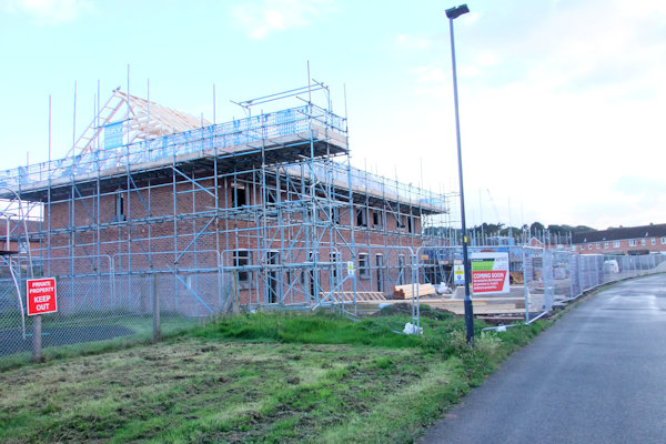
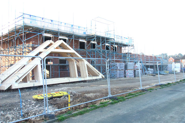
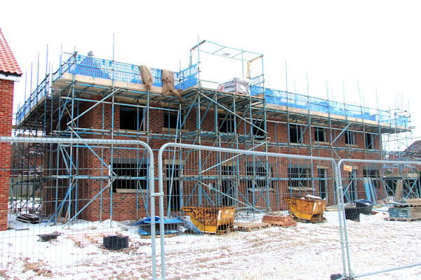
The
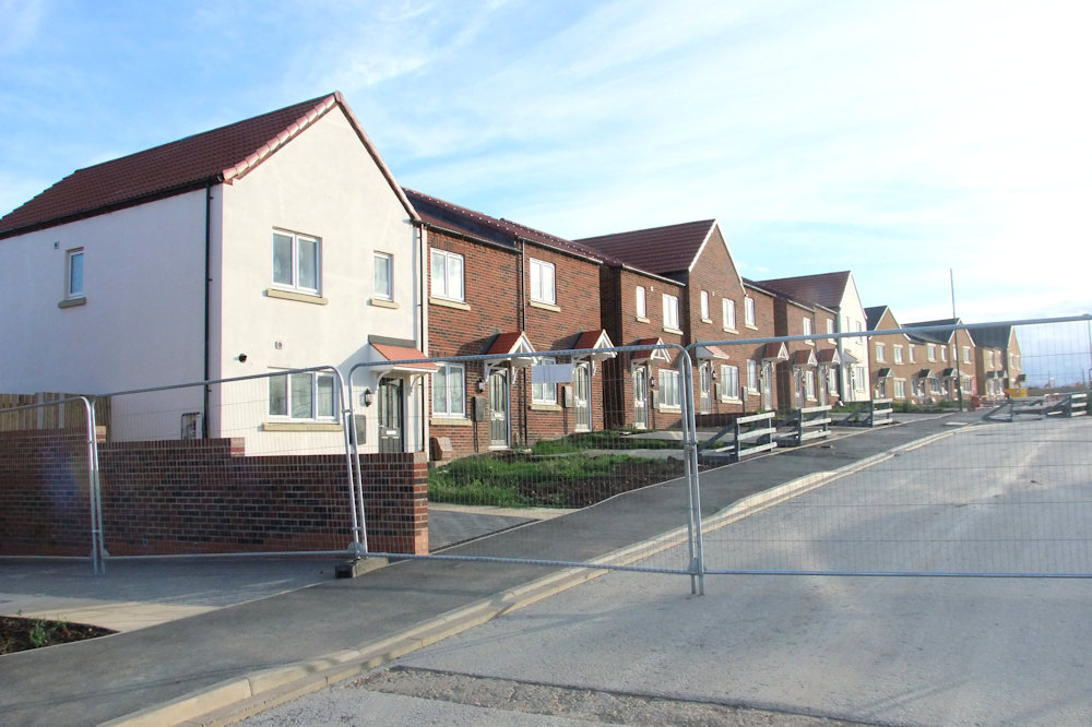
first phase of houses with an expected completion date around March 2018 were
released mid-September through Bridgfords. The first few houses were by this
time complete, including plots 1-5 & plots 35-38, with plots 6-11 being
completed shortly after. Electricity works were taking place at the end of
September lasing a few days at
Above from left: Plots 1-5 complete
with plots 35-38 also complete to the right; The site from Guisborough Road;
Electricity works at the junction of High Stakesby Road & Four Lane Ends
resulting in a partial road closure

Above from left: The site as viewed
from
Above left & Left centre: From
St. Andrew's Road looking into the far reaches of the site; Right centre &
Right; From the junction of

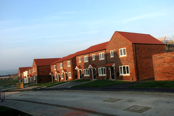
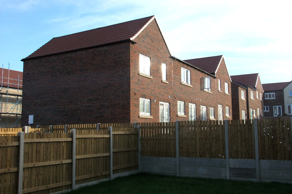
Above from left: The rear of plots 5-1 (left to right) with the rear of plots 38-35 to the extreme left; The front of plots 1-5 with plots 35-38 to the extreme right; The front of plots 1-5; Plot 32 with the roof on
Below from left: Plots 11-6 complete with parking areas being laid; The rear of plots 11-6 with back gardens being prepared

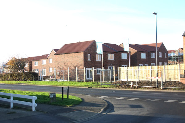
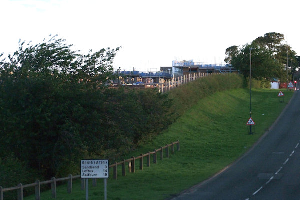
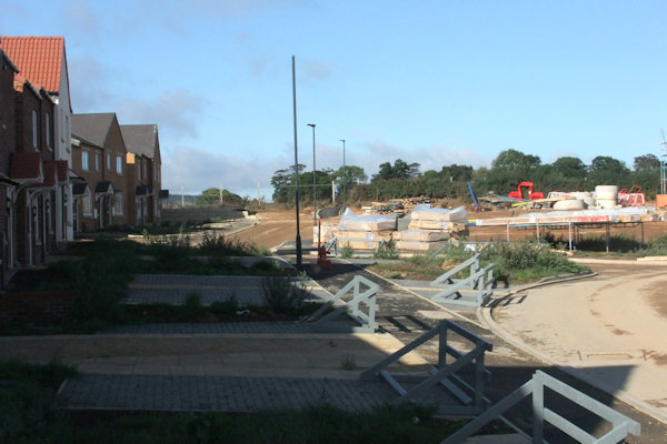
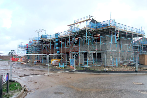
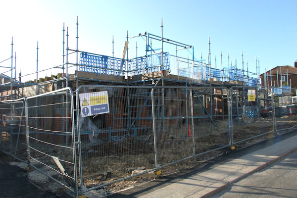
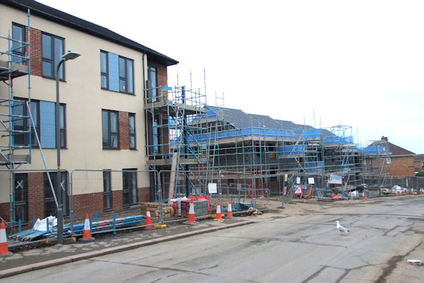
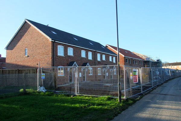
Roads,
pavements & street lighting were in place by late December 2017 with a
pavement also added up the side of the development on


Above left & centre: The entrance to the site with road & pavements now in place; Right: Looking into the site with road all the way to the far edge of the site with building work on all those plots on-going
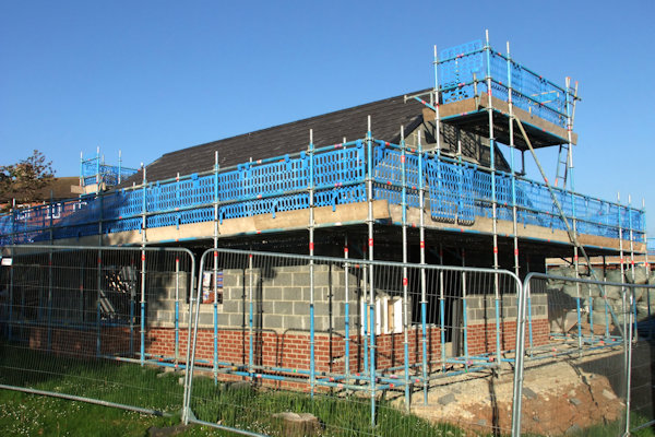
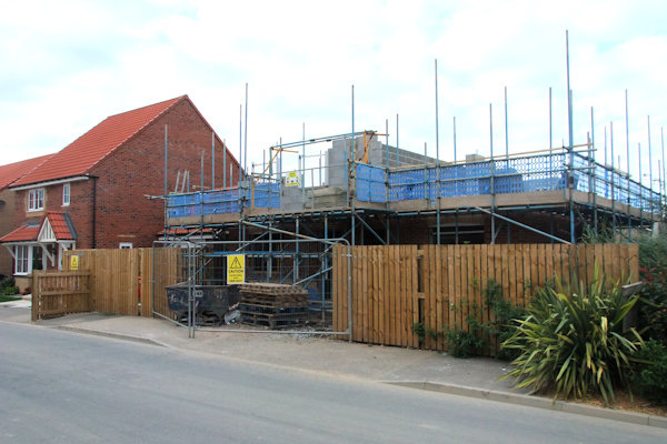
Work
started into the new year of 2018 on demolishing part of the old stone wall,
separating
Above from left: The back of

Above from left: The development now
stretches up towards

Above from left: The entrance to the development from High Stakesby Road with the show homes to the left; A view which will soon be impossible from High Stakesby Road; Pedestrian crossing work begun
Below from left: The new entrance to
the development from
More
road-work misery lasting 3 weeks arrived on 23rd April, resulting in


Above from left: The partial road
closure looking towards Four Lane Ends; The new footpath created looking
towards Four Lane Ends roundabout;
The new footpath round Four Lane Ends roundabout towards Mayfield Road; Work
complete, new left turn lane & wider pavement


Above from left: The new pedestrian Crossing in place also showing the new give-way lines at the entrance to the new development; Crossing now in operation
Above from left: The entrance to the
development along the newly-named Convent Way with the show homes on the left;
Looking along Convent Way towards what will be plot 31 with a parking area to
the extreme right; Looking down Sandstone Grove with plots 12-21 complete;
Sandstone Grove from Convent Way
Below from left: Plots 22-34 of Sandstone Grove complete; Plots 58-52 (near to
far) complete with plots 60 & 59 behind with plot 87 visible in the far
distance; The electricity sub station on Convent Way;
What will be plots 130 & 131 from outside plot 37 looking towards Sneaton
Castle Farm (yet to be demolished)
%20almost%20complete%20with%20plots%2060%20&%2059%20behind.%20Plot%2087%20is%20visible%20in%20the%20far%20distance.JPG)
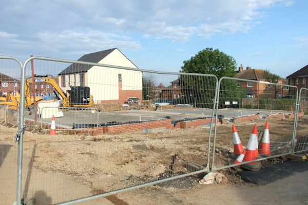
Demolition began at Sneaton Castle Farm in early June and was basically complete by the end of June.
.JPG)

Above from left: Sneaton Castle Farm
building during demolition from High Stakesby Road; The entrance to Sneaton
Castle Farm;
The entrance to Sneaton Castle Farm showing the shell of a farm building; The
rear of the farm viewed from the newly-created entrance from Castle Road to
Chancel Meadows


Above from left: The last section of Sneaton Castle Farm remains as seen from opposite the former entrance; The last section of the farm to be demolished as seen from the junction of High Stakesby Road & Castle Road; Sneaton Castle Farm gone; Showing the area where the barns stood


Above from left: Convent Way street sign erected; Foundations for plots 137-135 laid; The long building in the distance will house plots 127-124; Street signs for Sandstone Grove in place
Above from left: Looking across Convent Way from Sandstone Grove; Looking up Convent Way towards the road junction; Plots 39-47 of Convent Way; Plots 58-52 complete with plots 49 & 48 just visible beyond

Above from left: First row behind white house is plot 70, behind is plot 71 & behind that is about plot 80

Above from left: From outside the
show homes looking at what will be the gable end of plot 135; Looking
North-west from the show homes towards plots 132-134;
From outside plot 39 looking North-west with plots 100-103 nearing completion;
From outside plot 39 with the road in the distance eventually serving plots
94-88
By
November a number of roads were in place with houses popping up all over the
place, a number of these by this time were complete. The road into the site was
called '

Above from left: Plots 132-134 underway at Convent Way; Parking area for Convent Way with plots 147-144 behind at a higher level; Plots 139-135 now up to first floor level


Above from left: Plots 128-131 without outer bricks; Looking back down Convent Way at plots 47-35; Easter Court with plots 94-88 complete; Plots 124-127 almost complete


Above from left: Plots 161-58
in the early stages with


Above from left: Looking into Jet Close, Plots 76-83 complete at Jet Close; Plots 84-87 also complete
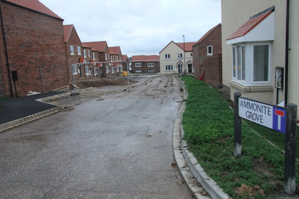
Above from left: Looking into Ammonite
Grove with plots 52-58 on the left, plots 59-61 ahead & the gable end of
plot 70 in red brick to the right;
Plots 71-75 of Jet Close with the entrance to Ammonite Grove; Plots 48-51;
Looking down the footpath between Convent Way (left) & Ammonite Grove (right)


Above from left: Plots 95-99 complete; Plots 124-127 now almost complete; Plots 161-158 in the distance with plots 121-126 to the right
By
April 2019 some residents of Ammonite Close had moved in and two former show
homes were sold off, plots 3 & 4 of

Above from left: Rear of plots
139-135 complete; Plots 128-131 complete along


Above from left: Plots 4 & 5 now sold off for private ownership; Plots 161-158 to the right distance almost complete


Ammonite Close - Above from left: Looking into Ammonite Close; Plots 67-70; Plots 62-65; Plots 62-65 to the right with plots 61 & 60 to the left with cream rendering
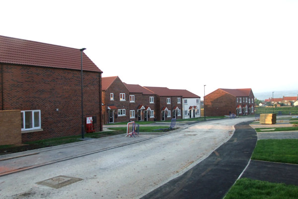
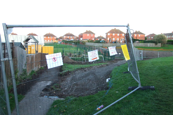
A children's play park was also added to the development with this work starting towards the end of Summer 2019. It was situated near Jet Close & Easter Court. New drainage was put in place near the bottom of Convent Way & Jet Close & Easter Court were tarmacked in September 2019.


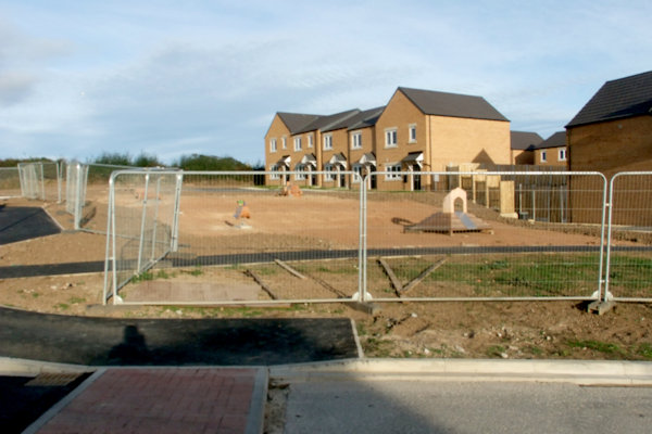
Above from left: The front of the houses off Convent Way facing High Stakesby Road with parking area behind now almost complete; Easter Court & Jet Close tarmarcked; Children's play area off Easter Court strated


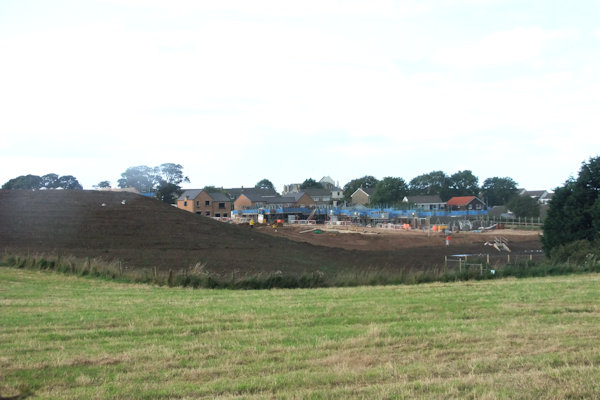
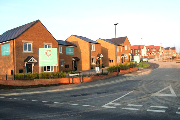
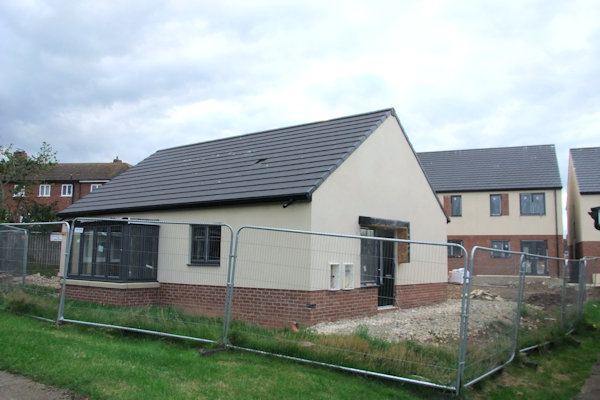
Above from left: The bungalows of the
site now complete from High Stakesby Road; The site from the site of Sneaton
Castle Farm, now gone;
The site looking towards Sneaton Castle from the corner of High Stakesby Road
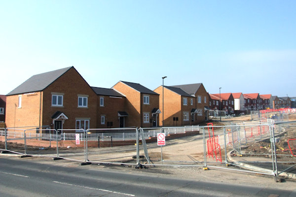
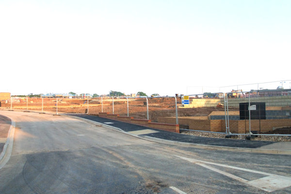
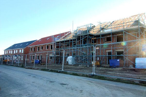
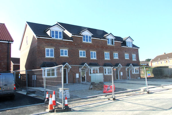
Work was well underway on the Castle Fields development by Autumn 2020.


Above from left: Plots 158-161 now
fully complete showing the rears of plots 166 & 167 through the gap in the
houses; Children's play park complete;
The first houses complete of Castle Fields showing plots 5-1 with plots 4 & 5
still with scaffold on; Behind plots 1-5 showing foundations for more dwellings
with the Chancel Meadows development visible in the distance
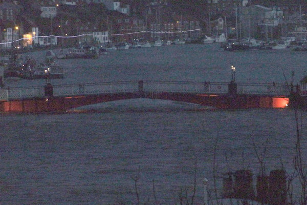
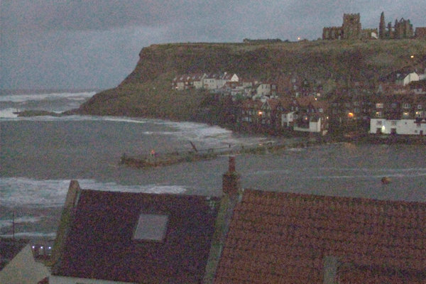
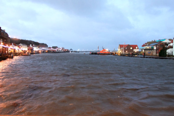
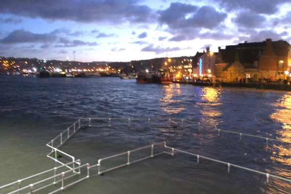
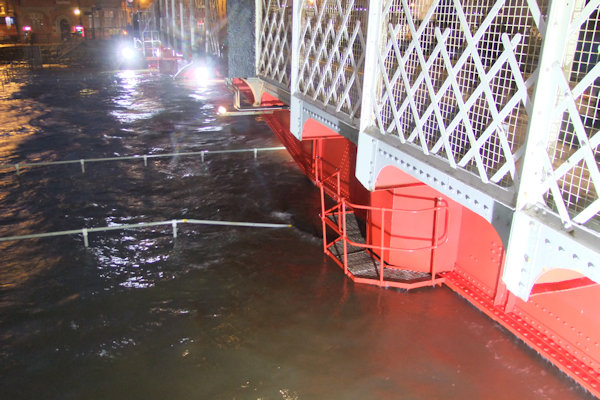
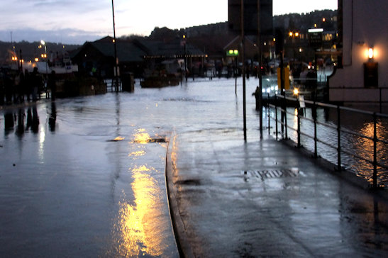
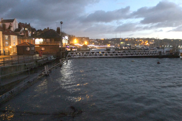
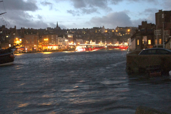
Friday
13th January really did bring with some bad fortune for the town as strong
North-westerly winds coincided with a 5.8M Spring tide at 4:30 in the afternoon
making the Harbour spill over onto surrounding streets. Road closures &
pedestrian cordons had been put in place for the high tide which came in the
early hours of the morning but that time they weren't necessary. But, as the
wind speed increased throughout the day & with the tide higher than the
early morning tide, the road closures were necessary this time. The road
closures included
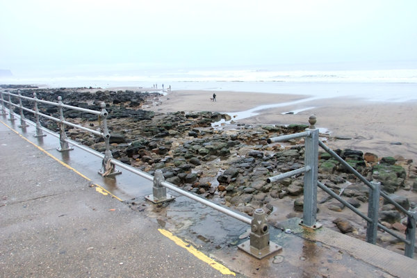
Below is a series of photos showing the chaos the high tide & strong winds caused. Photos taken between 4:20-4:50pm on 13th January.

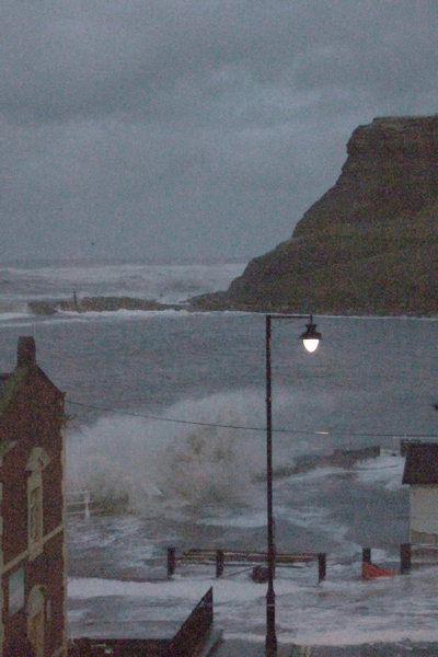
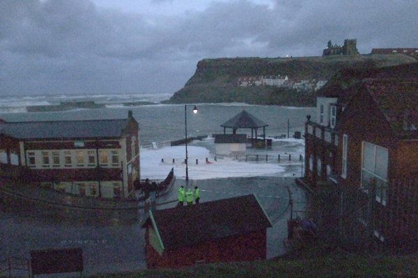
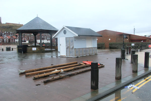
Above from left: Waves crash over the piers & extensions; The base of Trillo's ice cream hut; The ice cream hut now in front of the bandstand; Swing Bridge straddling a very full harbour
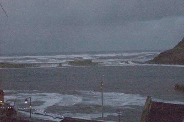
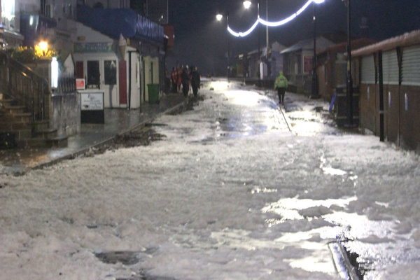
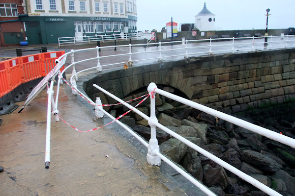
Above from left: The rough seas engulf the East Pier; Tate Hill Pier almost submerged; The Cragg looking North with the cordon across; Pier Road looking very foamy
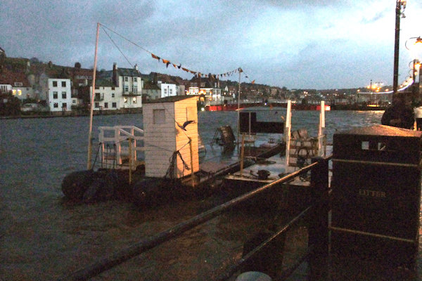
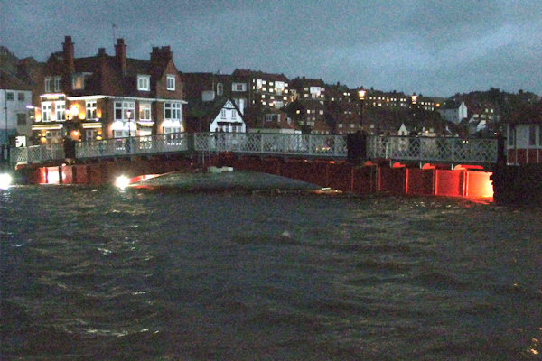

Above from left:From St. Ann's Staith towards Swing Bridge; Swing Bridge from St. Ann's Staith; From Swing Bridge looking North; Swing Bridge with Kiddies Corner completely submerged

Above from left: From near the Dolphin Pub towards Dock End; Swing Bridge from near the Dolphin Pub; New Quay Road towards Langborne Road; Closer to Langborne Road from New Quay Road


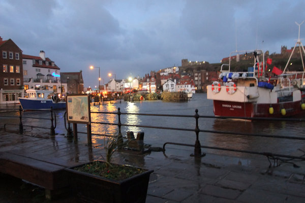

Above from left: The road closure from near the front of the Railway Station; New Quay Road roundabout; Dock End looking very full indeed; Looking North from the Swing Bridge
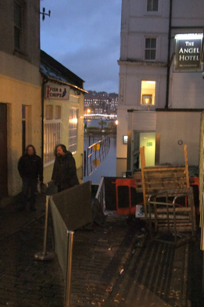
Above: Angel Yard from Baxtergate
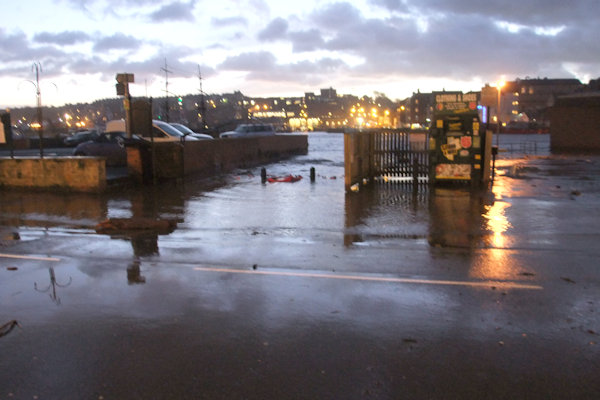
Above from left: Tin Ghaut car park full of debris; Tin Ghaut slip way from Church Street; The back of The Fleece pub & pontoons; Swing Bridge from Church Street car park
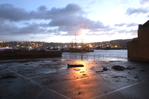
The
big clear up operation began the next day with
The following photos were taken on the morning of 15th January.
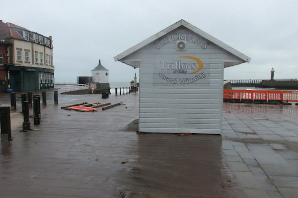
Above from left: Trillo's ice cream hut lifted from its base & moved about 20 foot; The base of the ice cream hut with the actual hut behind; Railings damaged near the bandstand

Above from left: Rocks moved across the sea wall from the sea defences; Damaged plastic drainage pipe from the cliff

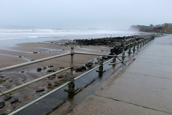
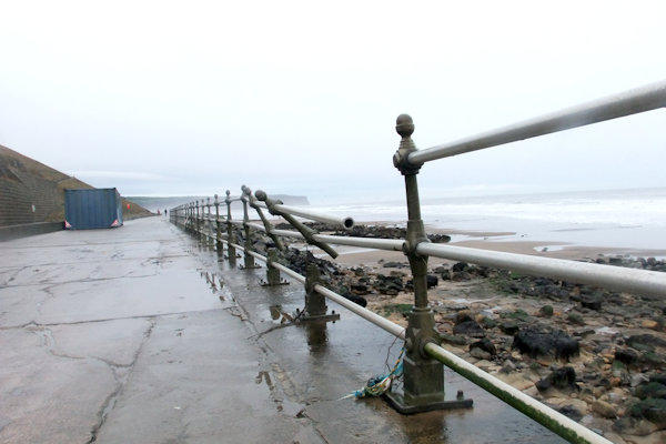
Above from left: Damaged railings at various points along the sea wall

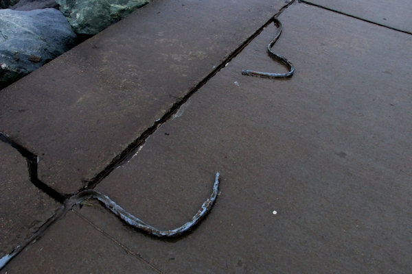
Above from left: Railings strewn over the other side of the sea wall; The base of the cliff has taken a battering; Water repellent sealant removed from the cracks in the concrete of the sea wall

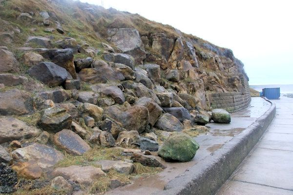
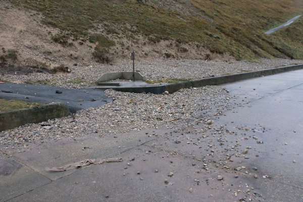
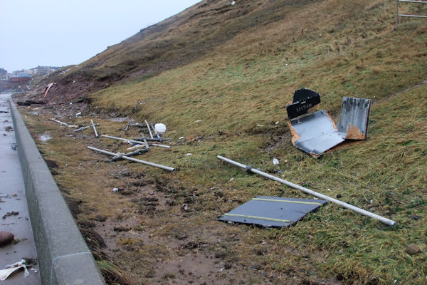
Above from left: A temporary steel container has taken a real battering, bending the side of the container inwards; Rocks moved about at the base of the cliff; Stones scattered all over the path from the base of the cliff
Improvement work was complete early in the year at Whitby Leisure Centre, managed by Everyone Active on behalf of Scarborough Borough Council. The £150k worth of upgrades saw the front of house area spruced up, a turnstile entry system introduced & the dance studio improved.
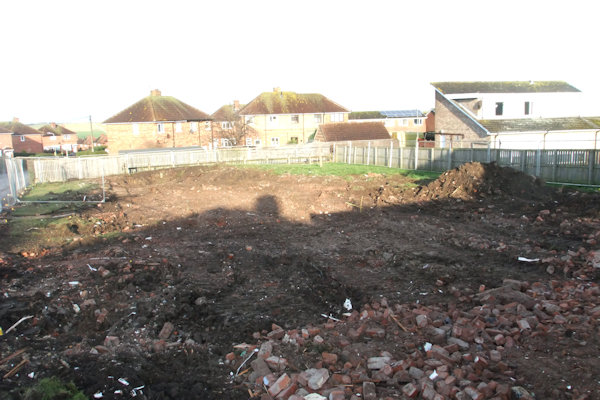
Demolition
work got underway at the flats at St. Peter's Road in the New Year after the
previous tenants had been re-housed in the newly-built flats off
Below is a series of photos of the flats from various angles showing them firstly as they appeared during the lengthy battle by local residents to save the flats from demolition, followed by some photos after the last residents moved out. Then finally we look at the buildings in their last weeks of life before they were flattened to the ground at long last.
The photos below were taken on 19th June 2014


The photos below were taken on 11th December 2016 - All residents relocated to Rohilla Close


The photos below were taken on 8th January 2017 - Hedges & tree removed


Demolition under way!


Above from left: The last 2 flats of the terrace still standing with no roof; The pile of rubble including baths & sinks; Looking down St. Peter's Road at the empty space

Above left: The second phase of flats demolished; Right: The land where the first phase of flats were situated levelled

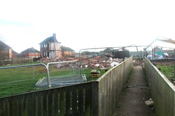
Above from left: The last section to
be demolished looking towards Helredale Road from St. Peter's Road; The empty
space between St. Peter's Road & St. Peter's Court;
Footpath from Helredale Road closed; Looking up the playing field into the
empty space
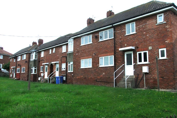
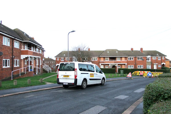
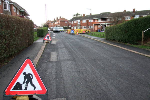
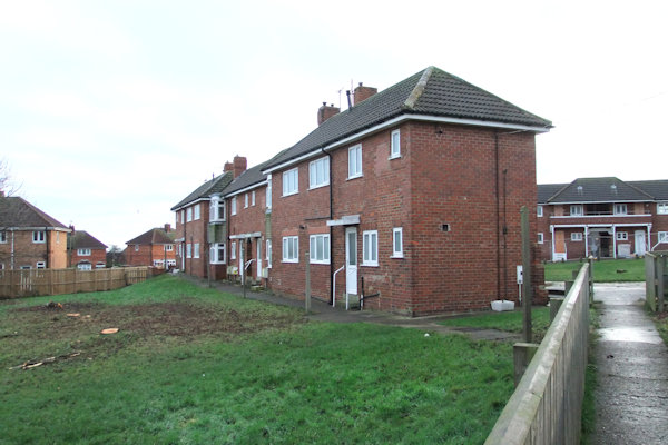
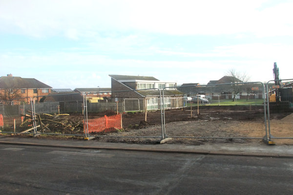
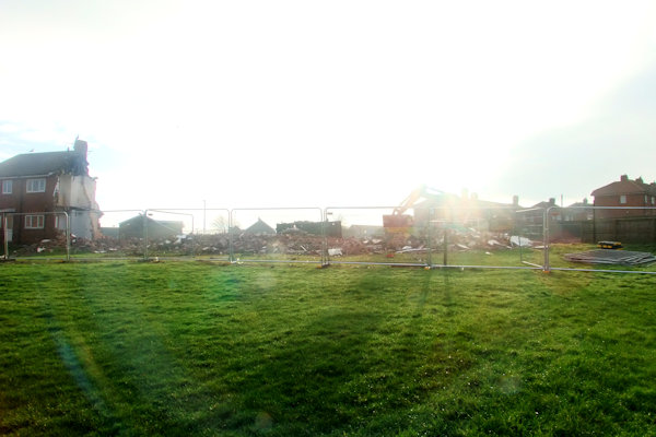
The
area was levelled and the next phase of demolition was the terrace of flats
behind
Above from left: From St. Peter's
Road towards Helredale Road; Towards St. Peter's Court, drains are being put in
place and foundations laid;
From the pathway to St. Peter's Court looking up St. Peter's Road showing the
foundations for the new dwellings; From St. Peter's Court towards St. Peter's
Road

Above from left: The area between St.
Peter's Road & St. Peter's Court; Right: The area between


Above from left: From St. Peter's
Road towards Helredale Road; From St. Peter's Court bungalows towards St.
Peter's Road;
From St. Peter's Court towards St. Peter's Road; Towards St. Peter's Road from the
bottom of the site
Above from top left: Towards
Helredale Road from St. Peter's Road; New kerbs laid for a new road junction to
the new development looking towards Helredale Road; The houses behind St. Peter's
Court looking North; The houses behind St. Peter's Court looking South;
Bottom: The new bungalow from St. Peter's Court almost complete


Above Left & Left centre: The
houses nearest St. Peter's Court making progress; Right centre & Right: The
houses nearest
Above from left: St. Peter's Road
towards Helredale Road showing the entrance road into the new development; The
new access road into the development looking towards Helredale Road;
The dwellings bordering St. Peter's Court are almost up, seen here from the
front lining St. Peter's Road
By August 2017, work was really making progress at the development with some of the dwellings by now been rendered.

Above from top left to bottom right:
The block backing onto Helredale Road; A block complete looking towards
Helredale Road;
The same block looking towards Helredale Road also showing foundations for 2
more dwellings; A row of houses backing onto St. Peter's Court almost complete;
Bases for more dwellings looking towards St. Peter's Court; The sole bungalow
from St. Peter's Court

Above from left: The houses backing onto St. Peter's Court almost complete except the furthest plot; The flats backing onto Helredale Road looking massive; The lone houses near Helredale Road complete
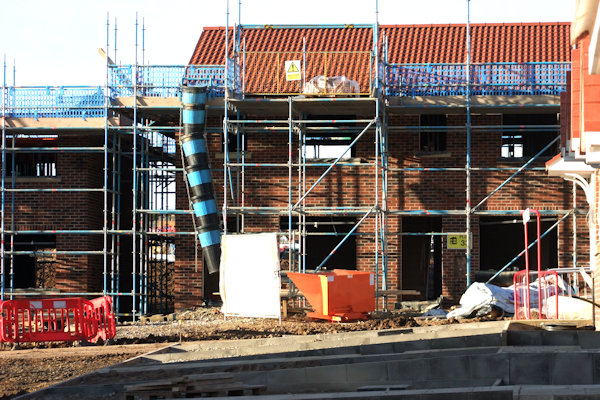
Into October roofing work was started on the structure of flats.


Above from left: The flats with the roof in the process of being put on; Another dwelling being built near to the rear of Helredale Road; 4 houses being built next to the flats; Empty space with St. Peter's Court behind


Above from left: The houses now with
driveways with St. Peter's Court behind; Roof now going on the 3-storey flats;
The entrance into the site towards the rear of Helredale Road; The houses
towards the bottom of the site with the rear of Helredale Road behind
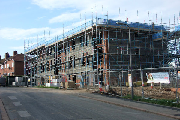
The structure for the flats was complete by early December 2017, at a similar time the driveways were laid to the front of the houses at the other side of St. Peter's Road.


Above from left: First houses to be completed now have driveways in front of them; The houses nearest the top of St. Peter's Road; The flats now complete; Houses behind Helredale Road

Above from left: The row of houses
nearest Helredale Road; The flats & row of houses nearest Helredale Road;
The block of flats near 24 St. Peter's Road;
The houses at the rear of the site near Helredale Road as seen from the field
near East Side Community Centre
Above from left: Fence erected at the southern end of the flats bordering 15 St. Peter's Road; The flats with perimeter wall built; The houses nearest Helredale Road now complete;
Above from left: The flats near 24 St. Peter's Road last to be complete; Gable end of the flats near 24 St. Peter's Road

Above from left: The houses nearest
Helredale Road; The house near Helredale Road with the access road to the rear of
the properties;
The flats near St. Peter's Court almost complete; The flats & houses near
St. Peter's Court from the rear
A
small road was laid between the flats & houses backing onto


Above from left: The flats backing onto St. Peter's Court very nearly complete; The flats at the other side of the road backing onto Helredale Road; The houses backing onto Helredale Road with a small road to the left
Below from left: The 4 houses on
their own near Helredale Road; The parking area at the rear of the flats with
rear of

After completion...


Above from left: The flats from the
top of St. Peter's Road & houses on the left of the road; The rear of the
flats with entrances & parking area; The rear of the houses on the left of
St. Peter's Road
Below from left: The secluded semi-detached houses near the flats' parking
area; The bungalow near St. Peter's Court; The houses & flats on the other
side of St. Peter's Road looking up the road

Work
lasting around 2 weeks by Yorkshire Water was underway in mid-January to
replace a valve in the pumping station at

Work at the pumping station by Yorkshire Water
Work was started sometime in January at HSBC in Baxtergate as they leased off former office space of the bank's premises to a new clothing shop called One Edge. The shop was open by late May.


Above left: HSBC & Harbour View cafe before changes; Right: Soon after work began

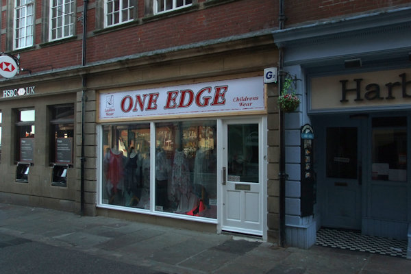
Above from left: The front taking shape; The new clothes shop One Edge open
A rear
extension to the adjacent Harbour View cafe was also being built to the


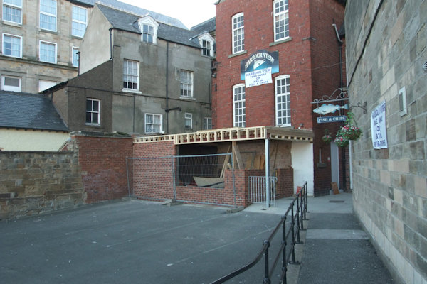
Above from left: The rear extension to the cafe; A closer view of the rear extension; The rear extension is slow-moving

Above: Extension complete sometime in July
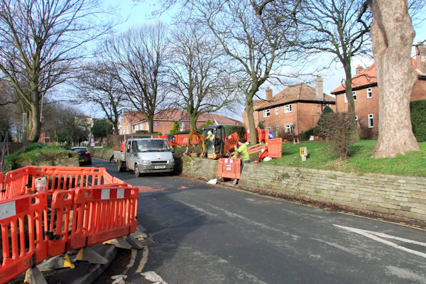
A
number of improvements to highways around the town were completed between
February & April as part of the agreement by Sirius Minerals in connection
with the new potash mine due to be sunk near Sneaton. The highways work all
paid for by Sirius Minerals included introducing tactile paving at junctions to
improve safety for pedestrians at the following locations;


Above from left: Helredale Road
uncontrolled crossing before a signalised crossing was installed looking down
Helredale Road & Up Helredale Road;
A month later - traffic island removed; Tactile crossing point installed on the
inner part of Helredale Road
Above from left: Crossing at Helredale
Road almost complete, railings installed on the footpath between Helredale main
road & side road; Crossing in operation by early April;
Pedestrian approach from the service road of Helredale Road

Above from left: Work underway at
Abbot's Road with its junction with Helredale Road to install tactile paving
slabs; Fairfield Way & Stainsacre Lane junction before any work was
undertaken;
Work complete installing lowered kerbs & tactile paving at Holmstead Avenue
with its junction with Guisborough road
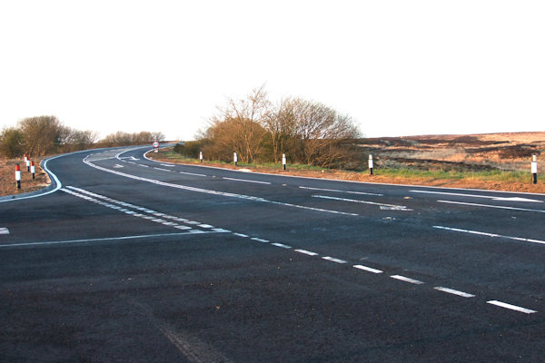
A right turn lane was also added on the A171 into the B1416 towards Sneaton & a similar right turn lane was added from the B1416 into the mine site. Work for this was started in February with the re-positioning of a dry stone wall at the entrance to the mine site to allow for road widening. The work at the junction of the A171 & B1416 was complete on schedule by 7th April however the mine site junction took a little while longer. A number of weeks later, the tarmac surface at the junction of the A171 & B1416 was ripped back up and re-laid with asphalt chippings. Someone appeared to have got that wrong as the markings were in place & everything before it was ripped up.


Above left: A171 looking South at the
junction with the B1416 where a right turn lane was about to be added; Left
centre: Widening the road on approach to the junction of A171 & B1416 from
Whitby;
Centre: A171 made wider South of junction with B1416; Right centre: B1416 with
A171 towards Scarborough to the right; Right: Towards Whitby at the junction of
A171 & B1416


Above from left: The lay-by area now
gone; The junction looking towards

Above from left: The B1416 at the
location of the new mine entrance before the right turn lane was added; Left
centre: Dry stone wall repositioned to allow for road widening;
Right centre; The mine site entrance, formerly a steel gate; Right: Dry stone
wall repositioned to allow for road widening, looking towards Scarborough
Above from left: The mine site entrance to the left looking South showing the extra width of the road; The mine site entrance looking along the B1416 towards the A171 nearing completion
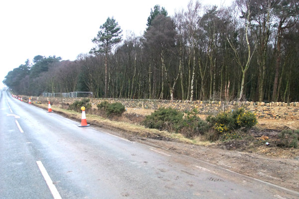
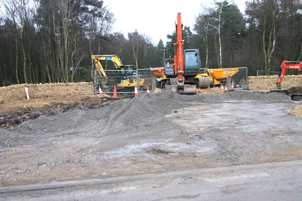
Work was on-going at the site of the mine through the year with screening of the site taking place and a 2-mile-long clearway added on the B1416. A number of road signs warning of no Sirius traffic were also erected around the area.
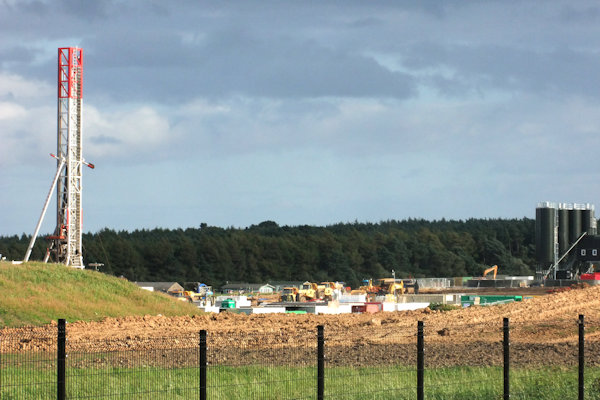

Above left: The mine site showing a drilling rig; Right: Looking South along the B1416 at the start of the clearway
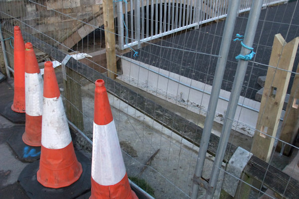
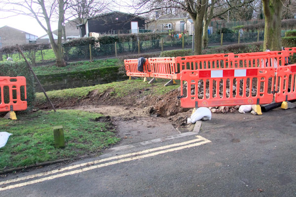
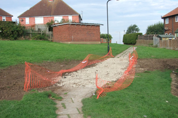
Work at East Row Beck to install a footbridge over the beck just North of the road bridge got underway in February. This would see the main road bridge have its pavements removed & replaced with cobbles to discourage pedestrians from using the bridge once the new footbridge was open. The bridge was lifted into place on 1st March and work followed this to tie it in to the existing pavement. The work was carried out by Hall Construction Services with help from Wilf Noble.

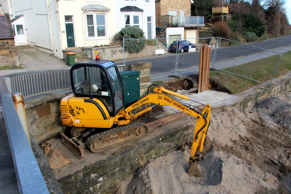

Above from left: The East bank of the beck being worked on; The West bank of the beck being worked on; The road bridge as it was
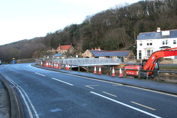

Above from left: The new footbridge in place on the approach from Whitby; The bridge from outside The Hart Inn; Showing the end of the bridge which is not yet joined to the bank side
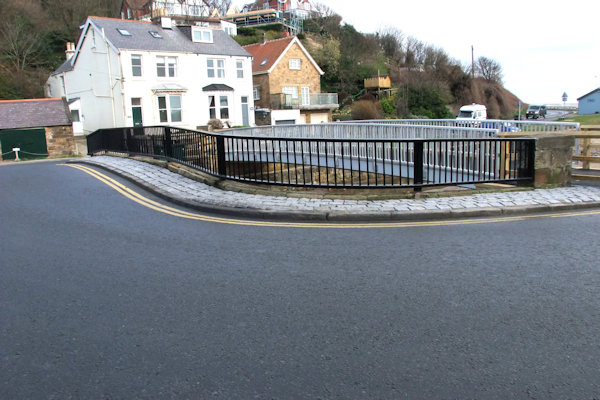
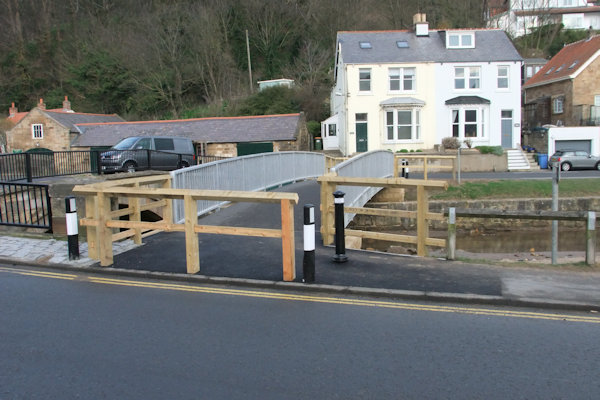
Above from left: Pavement surface laid to deter pedestrians from using road bridge; Footbridge approaches complete with fencing & central bollard to deter cyclists
Also around this time, just up the road work was underway nearby at Sandside Cafe which would involve extending the cafe to the East also providing an outside seating area. The work was complete in time for the Summer season by early June.

Sandside Cafe during & after completion of work to build an extension & outside seating area to the East of the cafe
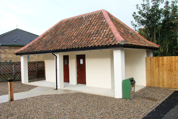
Work
started in February on the erection of a building to house public conveniences
in


Above from left: The former building
housing public toilets at the foot of Khyber Pass showing the entrance to the
Men's toilets down the steps;
The rear of the building facing Khyber Pass; The entrance to the Women's
toilets from Khyber Pass

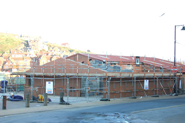

Above from left: The site of the new building with a wall removed; The building taking shape; The building just 1 week on as seen from the foot of Khyber Pass; The rear & side of the building from the Bandstand

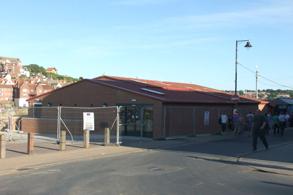
Above left: Work almost complete on the new building to house the public toilets; Right: Glass doors on the building
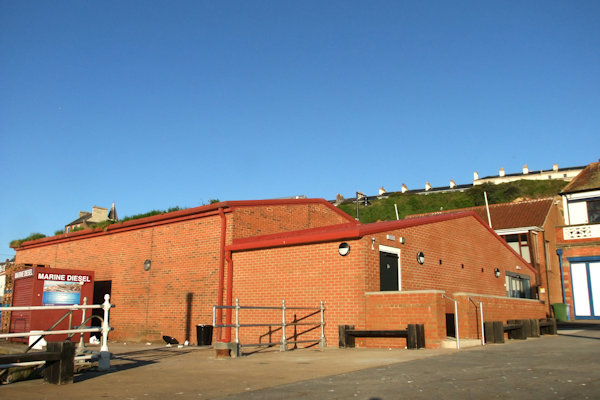
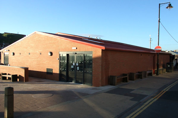
Work complete - Above left: The rear of the building showing the disabled toilet door behind the wall; Right: The entrance to the toilets
Whilst on the subject of public toilets, the toilet block at Eskdaleside in Sleights was closed and ripped apart which saw two disabled accessible toilets added with access from the front of the building and the men's entrance to the right of the building removed. A fence was erected to stop access to the rear of the building but a gate was installed to the left of the building.


Above from left: The former entrance
to the ladies' toilets was to the rear of the left side wall; The former
entrance to the gents' toilets was at the rear of the right side wall; Almost
complete - former
Back
in
Above: The new footway created
between - Left: Waterstead Lane & Right:
Work
at the B1460 from the Chubb Hill/Upgang Lane roundabout meant access to the
roundabout from Spring Vale was prohibited while underground utility works were
undertaken for a couple of days in mid-March. New signage was installed at
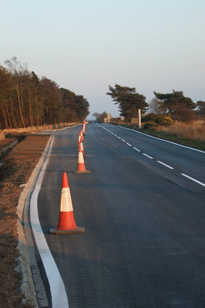
Pavement
resurfacing works were carried out throughout
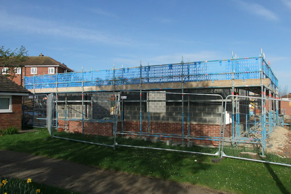
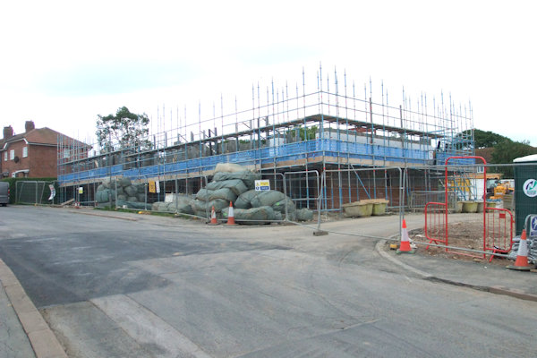
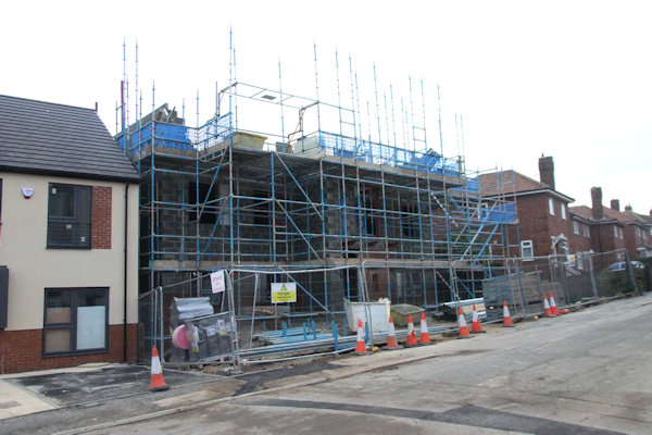
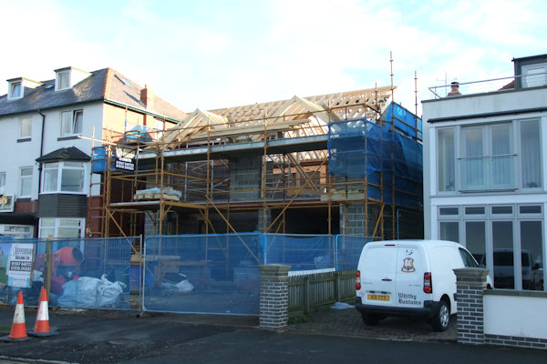
Work was on-going by March at 13 North Promenade which saw the bungalow demolished before being replaced with a 2-storey house. The building was pulled down which left a gap for a short while until the new building began taking shape. This was almost built by August 2017 with rendering taking place by October. The building & exterior work was complete by May 2018.
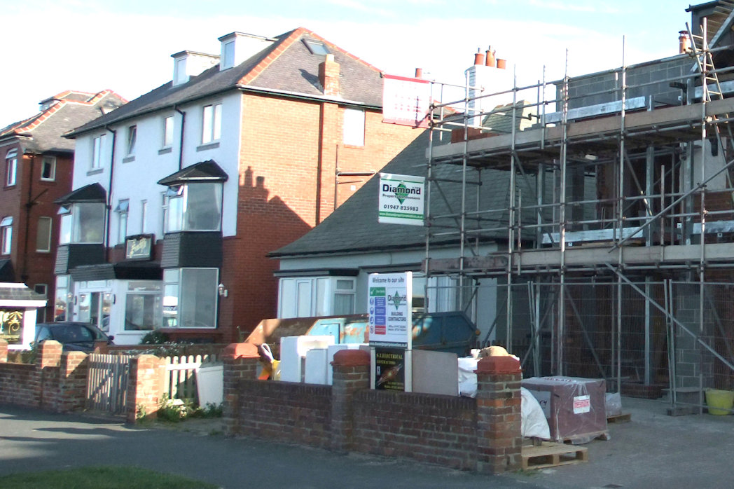
Above from left: 13 North Promenade as it was before work began; The building with no roof as seen here in early March; Looking into the empty shell with the Cricket Ground to the rear; 1 week later - Bungalow gone!


Above left, centre & right: Steady progress being made in June, August & September respectively; Rendering complete
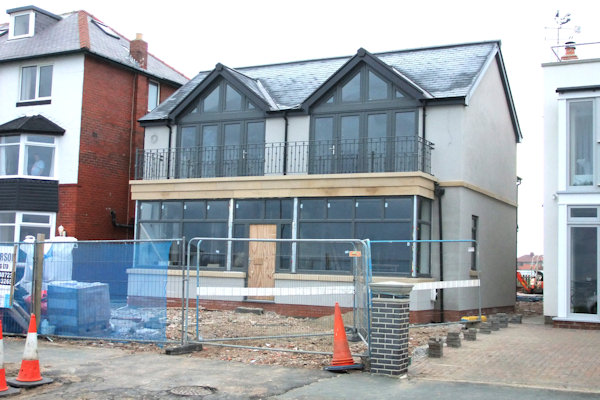

Above from left: Almost complete; Complete by May 2018
Pandemonium
shop on Flowergate closed its doors for good in early March after many years of
selling gothic items in the town. Another business soon moved into the building
however as by late June an antique shop The Golden Jackdaw had moved in.
Nearby, Flecks Boutique at 15 Flowergate changed names to The Wedding Shop
around this time. The main target audience of the shop remained the same. New
signage at Whitby Bus Station was erected in March stating Buses Only &
5mph. Work was being undertaken at the Cross Butts roundabout near the Park
& Ride site, with the kerbs on the approach from Guisborough & on the
roundabout itself between that exit & the B1460 junction, making the road
wider. Towards the end of March work was being carried out at

Above from left: Pandemonium closed down...; ...And becomes The Golden Jackdaw; New signs at Whitby bus Station stating Buses Only & 5mph; Cross Butts roundabout minor alterations
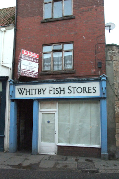
A family-run business which was forced to close in around 2012 due to ill health was about to disappear from the town after the building had been left as it was since closure. Whitby Fish Stores stood empty on the corner of Baxtergate & Wellington Road for around 5 years. The shop name was removed during early April & fascia paint was stripped. Also around this time, LiDL had a new sign added to the entrance to its car park, replacing a smaller one installed in 2013. A new business, Cod Roe Fish Mongers was open by mid-June.
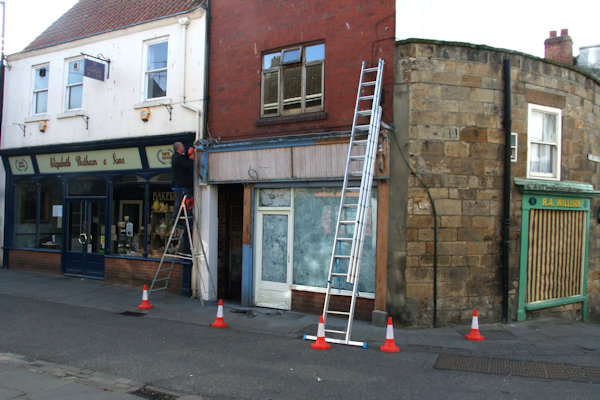

Above from left:
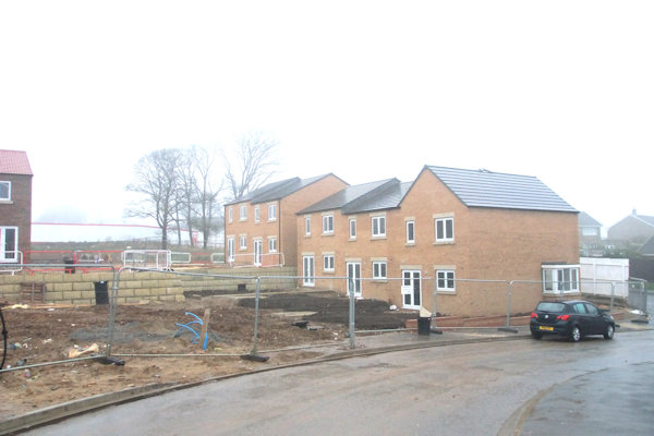
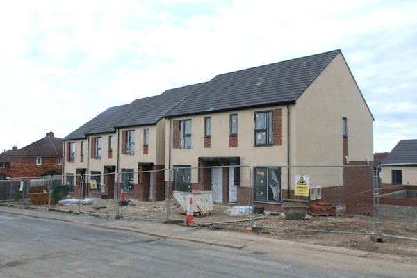
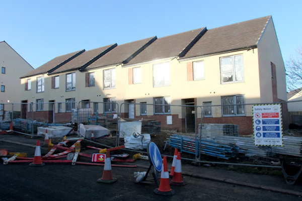
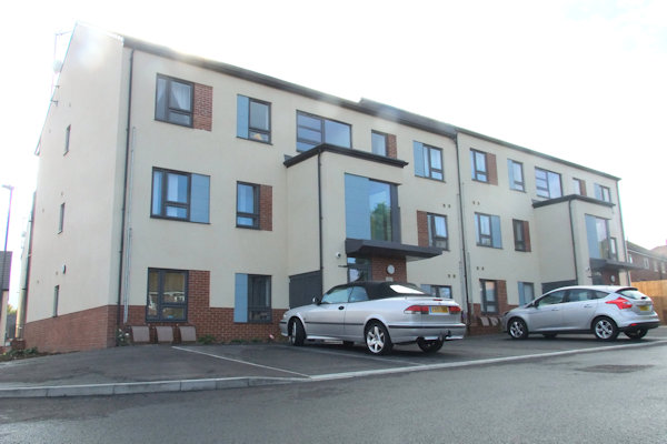
Work was also underway at Highfield Road Recreation Ground where previously 2 disused tennis courts stood, which would be replaced by an eventual total of 41 dwellings comprising of houses & flats. Planning permission for a residential development at this site was first granted in 2007. The first block to be built comprised of 4 houses with the second, third & fourth block containing 3 houses each. The first block was numbered odd numbers from 35-41

Above from left: Looking East along
Highfield Road at the foundations for some of the new dwellings; Looking West
along Highfield Raod;
Access to the site compound as seen from Derwent Road with Highfield road
through the gap to the right
Above left: The first dwelling to be started is making progression; Right: Showing the full length of the site


Above from left: The first houses to be worked on coming along nicely; Looking back at the first houses to be built from the end of the road; Foundations for the other houses nearer the end of the road in place
Above from left: The end of the site
loooking towards


Above from left: The dwellings
furthest from


Above from left: The houses nearest


Above from left: The first block of 4 houses now with door numbers; The middle of the site; The end of the site nearest Derwent Road with another block of 3 houses underway; Looking back at the row of houses


Above from left: The first plots to be completed now with driveways and the other 2 blocks are now built; The last block is up to first floor level; The block of 3-storey flats; The same block almost complete

Above from left: The last of the three terraces of houses complete; The flats nearing completion


Above from left: The row of houses
looking towards the end of the cul-de-sac; The end block nearest Derwent Road
almost complete;
The separate block to the rear of the row; Looking North-west with the separate
block to the right

Above from left: The last section of houses from phase one now complete; The next phase of work started
The next phase of work got underway soon after completion of phase 1 at Highfield Road which was on land beyond Highfield Road between that and Derwent Road as an extension of Highfield Road.


Above from left: The new road in place as viewed from the end of the original Highfield Raod; The new houses taking shape


Above from left: The extension of
Highfield Road with the houses now taking shape; Mid-way through the development
from Derwent Road;
A little further through the development from Derwent Road; The end of the
development viewed from Derwent Road

Above: The area being prepared for phase 3 of the development
A new
6-foot-high metal gate was erected at the entrance to

Above from left: The new gate at the entrance to Well Court; The new surface laid down the top section of Caedmon's Trodd; The new paving at the top of the steps from Church Street to Caedmon's Trodd
By
April work was underway on converting the former Tourist Information Centre
into a fish restaurant. The restaurant was opened by Whitby-born man Andrew
Pern who also had restaurants in other towns.

![]()
Above left: Work underway at former
Tourist Information Centre; Right: Hatch markings at entrance to

The building transformed
Also at this time, LiDL supermarket had a new sign installed to the entrance to their car park, replacing the smaller sign installed in 2013. The new sign followed a large-scale in-store refit.

Above: New sign for LiDL at entrance to their car park
Also
around this time, the whole of
A
major fire broke out in the roof space of the Magpie Cafe on Sunday evening of
30th April. The fire broke out at 10:15pm and fire fighters from all over the
area battled well into the early hours of the morning to bring the blaze under
control. There was damage to the roof tiles but the takeaway re-opened the next
day, Bank Holiday Monday. Eight engines were involved in the operation
including a turntable engine from
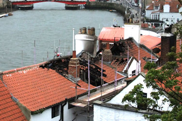


Above top: Magpie Cafe from Pier Road
with the scaffold in place ready for repair work to begin;
Bottom left: The rear of the property along The Cragg showing how close the
other properties are to the building; Bottom left centre: The roof the Magpie
from the steps leading down to The Cragg;
Bottom right centre & Right: The roof of The Magpie from Spion Kop

Above: New roof being fitted to the Magpie
A care
home based at Hawsker closed its doors for the last time in late April after
receiving a lot of poor media attention in recent times. Hawkesgarth Lodge
closed for the final time with residents being forced to re-locate to
alternative care homes. The ultimate reason behind the closure of the home was
due to a shortage of nursing staff. The building was used as a lodge for the
workers at the Woodhouse Mine for some time after the closure of Hawkesgarth
Lodge. Incidentally,

Above from left: The original part of the building facing Hawsker Church; The side of the building adjacent to Hawsker Lane; The rear of the building; The rear car park
Work to the gas supply was underway by early May at the junction of Mayfield Road & St. Andrew's Road meaning temporary traffic lights were necessary and the closure of the junction of St. Andrew's Road & Mayfield Road.
New
signage was added to the top station building of
Above:


Above: The entrance to
Another
business to close its doors around May was Ancient Warrior, leaving its other
shop open in


Above left: Ancient Warrior closed down; Right: JK's Bar with its new red colour scheme
The
western gate of
Above from left: The temporary gate
on the
Also
in May, work was undertaken by Scarborough Borough Council placing flower beds
at the junction of Mayfield Road & Prospect Hill on the wide pavement area
to the South-west of the junction. A 'Slow' warning was also painted on the
road about 10 metres from the

Above left: Home & Lifestyle shop
in its former location at
Work
had been on-going for a number of weeks creating a larger private parking space
off the old
Above left: Parking space made larger
& stones from old
A refurbishment scheme was complete by Summer of this year at The Ship Inn at Marine Parade. External alterations were carried out which was followed by a complete overhaul on the inside.
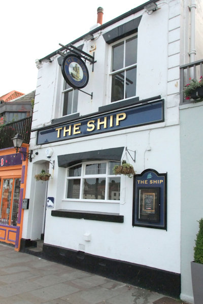

Above left: The Ship Inn from Marine Parade before alterations to the ground floor window were carried out; Right: The Marine Parade facade after work
Bobbins
wool & haberdashery shop in


Above from left: Bobbins,
Work started on the evening of 1st July at the corner of Church Street & Bridge Street to restore electricity & gas supplies after what was described as a gas explosion had occurred underground. The teams worked through the night and into the next day to sort the problem.
Nearby,
Great Reads Whitby book store at
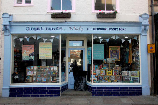
Great Reads,
The
site office for the on-going housing development at Larpool was demolished and
replaced by 2 houses around July with the building of the houses continuing
into September. By this time the whole of
Above left: The site of the site office during demolition; Right: The site office being replaced by plots126 & 127


From left: The West entrance into
Wagtail Crescent - plots 73-75 almost complete; The front of plot 73;
The back section of Wagtail Crescent showing plot 70 behind the car with plots
71, 72 & 84 to the right & plot 88 in the top corner;
Looking back down from the top along the back section of Wagtail Crescent
showing plots 72 & 71 with plot 84 in the foreground


Above from left: The first play equipment in place soon to be removed; The equipment re-instated in Spring 2018
Whitby
RNLI's new inshore lifeboat was officially named in July as Warter Priory after
the Warter Priory Estate in
Highways
work was taking place on
Sometime
at the beginning of August Siggy's Fish Shop at Angel Yard was taken over &
re-named Angel Fisheries. At a similar time, Stonehouse Emporium at
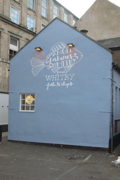


Above left: Angel Fisheries in the former Siggy's Fish Shop premises; Centre: Stonehouse Emporium just after having its fascia signage removed; Right: Mademoiselle's Cafe open
On
20th August Arriva buses who operated the services to Sleights & Eskdale
were to change routes with the 94 Eskdale service effectively scrapped, but
being covered by the 95 Sleights running a different route, which would also
cover Sainsbury's, as that route, which was previously free, was also scrapped.
The company announced that timetables would remain the mostly the same. The
change also saw the
Above from left: The single yellow line on the right side of the road looking towards Rose Avenue; The double yellow lines with Ocean Road to the right; New direction signage added to the top of Downdinner Hill
Work
was started at the end of August at the junction of Windsor Terrace & North
Road to allow aging gas pipes to be replaced with plastic ones. This resulted
in a road closure was necessary from the point at the foot of
The
pedestrian crossing at the foot of Helredale Road was upgraded which saw new
traffic lights installed during work which required temporary traffic lights to
be in operation for a number of days. This was followed with similar work
taking place at the pedestrian crossing on
Sugar
Shack, selling sweet treats & drinks, based at

Above: Sugar Shack simplifies its name to 'The Shack'
Moving North to Staithes, Staithes Athletic FC & social club unveiled its refurbished changing facilities which were made possible thanks to a grant of £25,725 from the Premier League through the Football Stadia Improvement Fund which went a long way towards the £37,725 cost of the project. £6,000 was raised by members of the Staithes Sport Association & £3,000 came from the Normanby Charitable Trust. The changes meant the ground met the criteria for step 7 of the F.A Ground Grading requirements, which the club currently competes at. The improved facilities were officially opened by club vice-chairman Paul Conway on 16th September which meant the pavilion now offered separate home & away changing facilities as well as two officials' changing rooms & a versatile open area with two store rooms. The club completes in the North Riding Football League.
Also
around this time, a
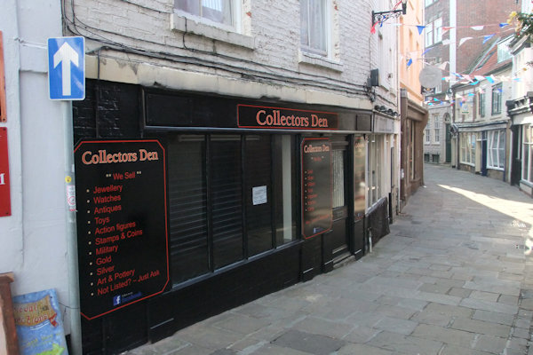
Above: Collectors Den moves into premises previously occupied by Endeavour Books
Work
took place towards the end of September at


Above from left: Creation of a new footpath underway; The tennis court perimeter fence removed; Small children's play area removed; Section of existing footpath removed
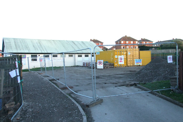

Above: The whole area is fenced off looking towards St. Peter's Road; The former paved footpath removed; The parking area; The tennis courts

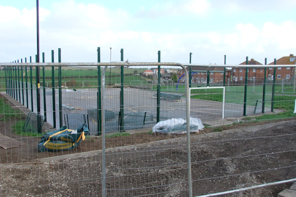

Above left to bottom right: Entrance
from Abbot's Road; New fencing round the tennis courts; New path laid looking
towards St. Peter's Road;
New excercise equipment installed near to where former swings & see-saw
was; New play equipment for younger kids installed; New pathway laid towards
tennis courts with benches

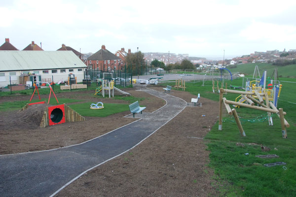

Top left to bottom right: The entrance to the centre with tennis courts to the left; Surface laid on parking area; The parking area; The larger play area now turfed with bins & lighting; The smaller play equipment in place
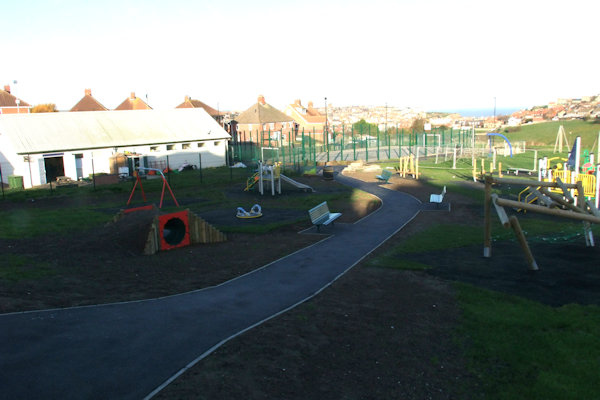
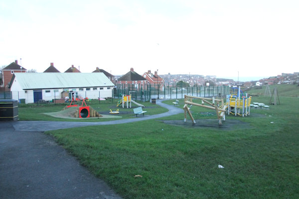
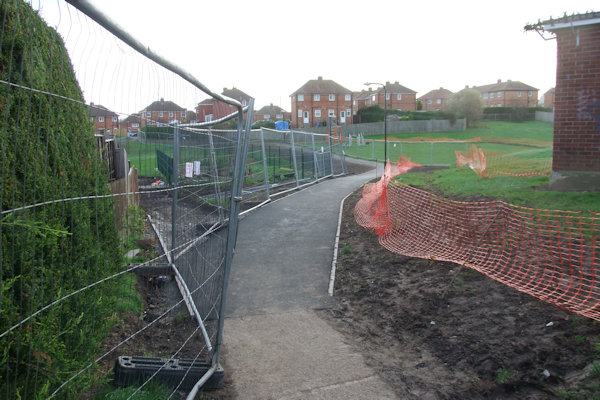
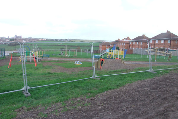
Above from left: The newly-developed site looking towards Abbot's Road; The new children's play area
Work
which involved replacing broken railings along the edge of the riverside
footpath underneath the viaduct was undertaken around the beginning of October.
New metal railings were put in place making the route safe for walkers once
again.
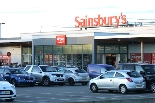
Above: Sainsbury's
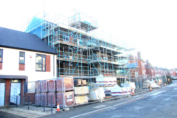
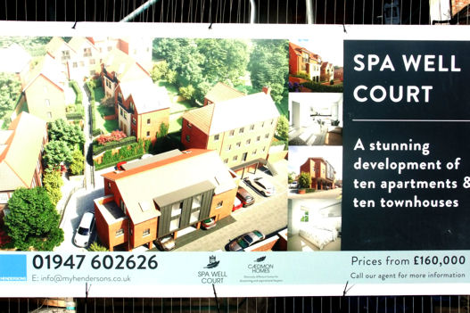
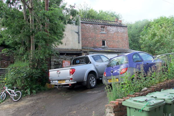
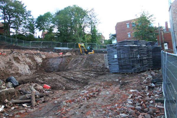
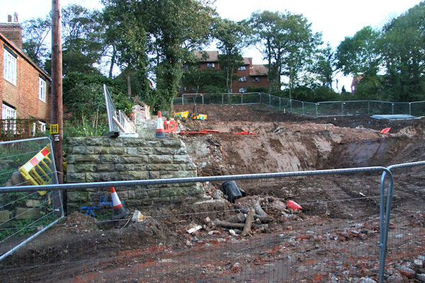
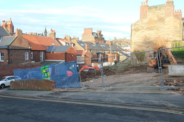
Work was on-going at the rear of Broomfield Terrace preparing the land on the bank side for houses after a derelict house was removed along with various trees. A 10-foot trench was dug into the flat land at the bottom of the bank next to the road of Broomfield Terrace. Planning permission was first sought as early as 2002 for a residential development to be housed on the site of the previous Bagdale Garage. The derelict building suffered fire damage in 2007 but the building was already in a derelict state. Here's a look at what the new development, Spa Well Court, will look like once finished.
Above left to below right: Derelict
building before being demolished at the town end of the site; Looking across
the site towards the new flats; The town side of the site looking towards
Meadowfields Court;
Towards the rear of the site below Meadowfields Court nearest town;
The large hole excavated looking towards town; Looking into the large trench;
The large trench looking away from town


Above left: Temporary steps erected
to access the neighbouring house to the left of the site; Centre & Right: Looking
up towards

Above from left: The large scale of
the site; Large wall built at the top of the site below
The work seemed to be at a standstill for a number of months. Below are some photos from November 2018, a crane had arrived on-site.

Above from left: Hardcore down; The base of the crane; The huge crane towers above
Below left & left centre: From near Bagdale sub-station looking across the site; Right centre & Right: Similar viewpoints taken 2 months later


Work really started to take shape in early 2019 after all the initial ground works & excavations had been carried out.


Above from left: Steel for another structure in place; A block of properties towards the back of the site; Another block of properties towards the back of the site; The first block to near completion

Above from left: The eastern end of the site; The main building nearest the road taking shape; The western end of the site
The development was taking shape by Spring 2020, as seen below.


Above from left: New houses complete
with white render; The building nearest the road of Broomfield Terrace;
A view along Broomfield terrace with the new buildings on the right; The larger
building set back from the road
The development was completed during 2020, as seen below.


Above from left: Looking up to the development; Along the front of the development; Around the back of the front part of the development; The flats along the front of the development


Above from left: Looking up towards the very top of the development; The rear gardens of the top houses of the development; From the top of the development looking down towards Bagdale
Meanwhile, nearby land at Spring Hill was being developed, formerly occupied by Mr. Bee's Dental Practise and used as a car park. The land which was sloping was made into flat, stepped terraces where a terrace of 3 houses would be built & was once the home of the town's police station before the present one was built in the 1960's.
Above: The land from Spring Hill; The land from below showing the stepped terraces
1 month on - drainage going in


Above: Drainage going in

.JPG)
Above from left: The site looking up towards the telephone exchange; Block work started looking towards Spring Hill
.JPG)
Above from left: From Spring Hill
looking across the site; From in front of

Above from left: The front of the houses from Spring Hill; The lower side of the houses; The rear of the houses looking towards Spring Hill
.JPG)
Above from left: Progress made
looking from Spring Hill; The view from
.JPG)
Above from left: Building work coming along nicely as viewed from the corner of Spring Hill & the rear of Victoria Square; The houses up to roof level as viewed from Spring Hill


Above from left: The houses from the
bottom of the site from

Above from left: The houses from the
bttom & rear; The houses from the front from
Above from left: Houses almost complete by February 2019 as seen from the front; From the rear


Above from left: The houses from
Spring Hill now complete; The front of the houses from
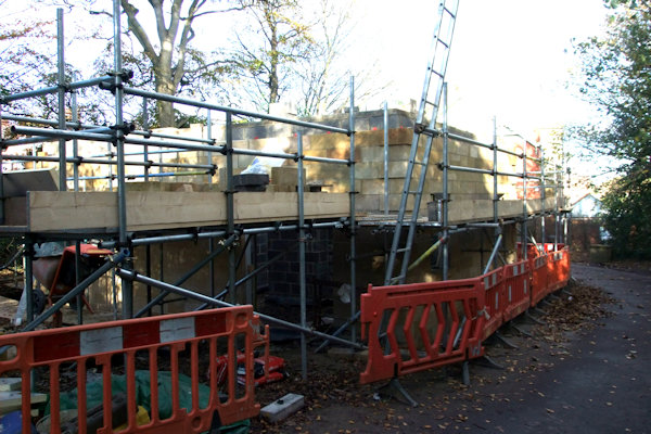
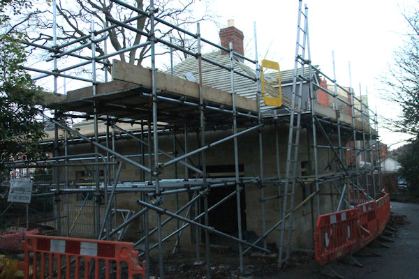
Building work for a 2-storey house was started around this time just inside the private driveway to Airy Hill Manor behind the wall near the Propsect Hill traffic lights. The house was built from sandstone and even boasted a real fire with chimney! The house was complete for early 2019 with steel gates erected to the entrance road.
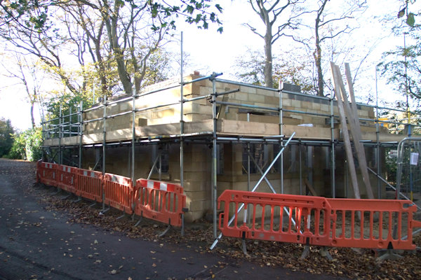
Above from left: Building work
started as viewed from just inside the entrance to Airy Hill Manor; Looking
towards

Above from left: The house as viewed
from the entrance to Airy Hill Manor driveway; The house from the back looking
towards
Above from left: The house as seen
from the entrance to Airy Hill Manor driveway; The house from the rear looking
towards


Above from left: The completed
building from the entrance to


Above from left: House complete with gates to the entrance
Work
was underway by the end of Summer at
Above: Work began
An interactive tourist information board was installed at Dock End sometime in October but wasn't put into use until December - the start of the main tourist season... for Santas! Just across the road in front of the railway station, a bench was unveiled in the first week of November with its location being chosen by Whitby Town Council.


Above from left: Interactive tourist information board; New bench
Work lasting a proposed 19 weeks, but was actually much longer, was started at Sleights bridge in mid-October which involved removing the top horizontal rail from the railings of the bridge at both sides and wrapping the bridge with scaffold which went underneath the roadway. This was to allow the bridge to be treated to maximise its lifespan. This meant 3-way traffic lights were necessary for the duration of the works at the junction of The Carrs. The work was complete by May when new owners of nearby Salmon Leap decided to fell a lot of trees on their land, next to the bridge.
Above from left: Sleights bridge from West to East; The railings with the top rail removed, showing the northern side of the bridge looking East; The hole is where the top horizontal rail used to join the pillar


Above from left: Sleights bridge surrounded by scaffold; The East side of the bridge; Work complete; Trees felled nearby in other works at the Salmon Leap
Also
around this time, work lasting 1 day took place on the upward side of
Downdinner Hill to re-surface the road to smoothen out a bump in the surface.
Elsewhere in town,
Victorian Image on Sandgate closed its shutters for the last time on Sunday 19th November as owner Paul Wilson wanted to pursue photography more after running the business since 2000. The shop had been a part of Sandgate since 1980 and was to be converted to a retail premises. A new business 'Furbellow & Co' opened in its place in early 2018 selling gentleman's clothing.

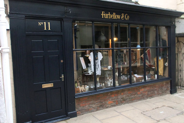
Above from left: Victorian Image, 11 Sandgate closed after 37 years; Furbellow opens early 2018
Work started around November at Aelfleda Terrace, which would see the 3 cottages demolished after a landslip in November 2012 sent the gardens of the cottages down the cliff a few feet. After assessing the cottages it was decided they were no longer safe and the only option was to demolish them. It was revealed around a year later though that in fact the ground on which the cottages stood was solid and the 151-year-old cottages were demolished for no reason at all.

Above: Work started at Aelfleda Terrace
Work was
started during the latter part of the year on constructing a retaining wall
along a stretch of


Above from left; Looking South just
south of The Fleece; Looking South a little further along Church Street;
Notice placed on Church Street warning of the work & for lobster pots to be
moved; Part of Church Street made 'no parking' in June 2019


Above from left: The flood defence wall complete; The 2 small buildings re-built
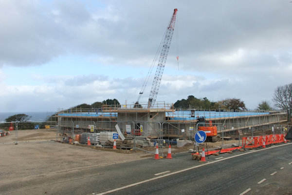
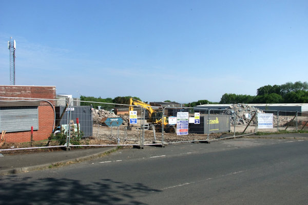
Towards
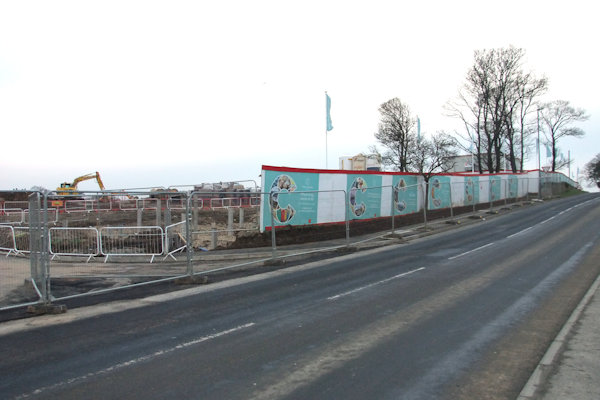
the end of 2017, planning permission was granted to Aldi & Marks &
Spencer to build 2 stores on land just off
Above from left: Preparatory work in February 2014 at the site of what will be Sky Scaffolding's new compound

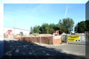

Above left & Centre: Work resumes in June 2017; Right: The compound ready - October 2017

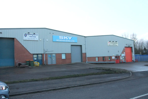

Above from left: Sky Scaffolding at their old home; Sky Scaffolding's new home; Right: Sky Scaffolding's new compound
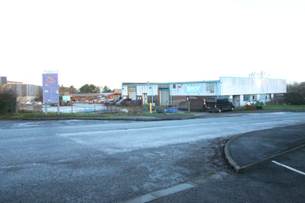

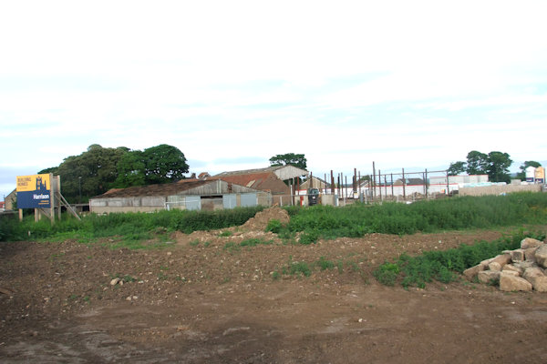
Above from left: Sky Scaffolding's old home; Eve's former offices set to be demolished viewed from the rear; Eve's former offices from opposite Homebase; Eve's former offices from the entrance road to Homebase
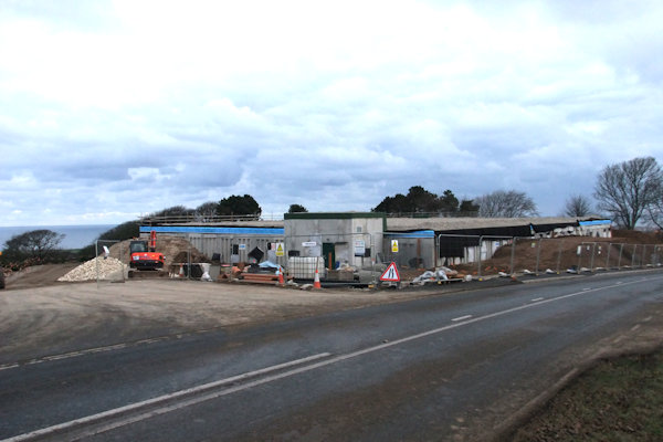
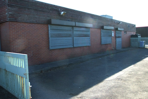
The site of the former Eve's offices & Sky Scaffolding premises was cordoned off in April 2018 & actual demolition work started around the second week in May. The first unit to vanish was the steel shed unit nearest Homebase, taking only a couple of days to remove it.


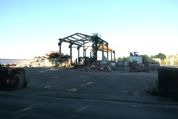
Above from left: Demolition work begun on the metal-framed building; The site looking towards the side of Homebase; Demolition work began at Sky Scaffolding's former premises


Above from left: Demolition in progress with the metal shed unit completely gone; A view from Fairfield Way towards the side of Homebase; Demolition work started on Sky Scaffolding's former premises
Frame-work soon appeared on site after initial ground works were completed.


Above from left: The space to the
left of what was Sky Scaffolding with Eves' former offices still standing to
the left; The site of the former premises of Sky Scaffolding, reduced to rubble
within the last week;
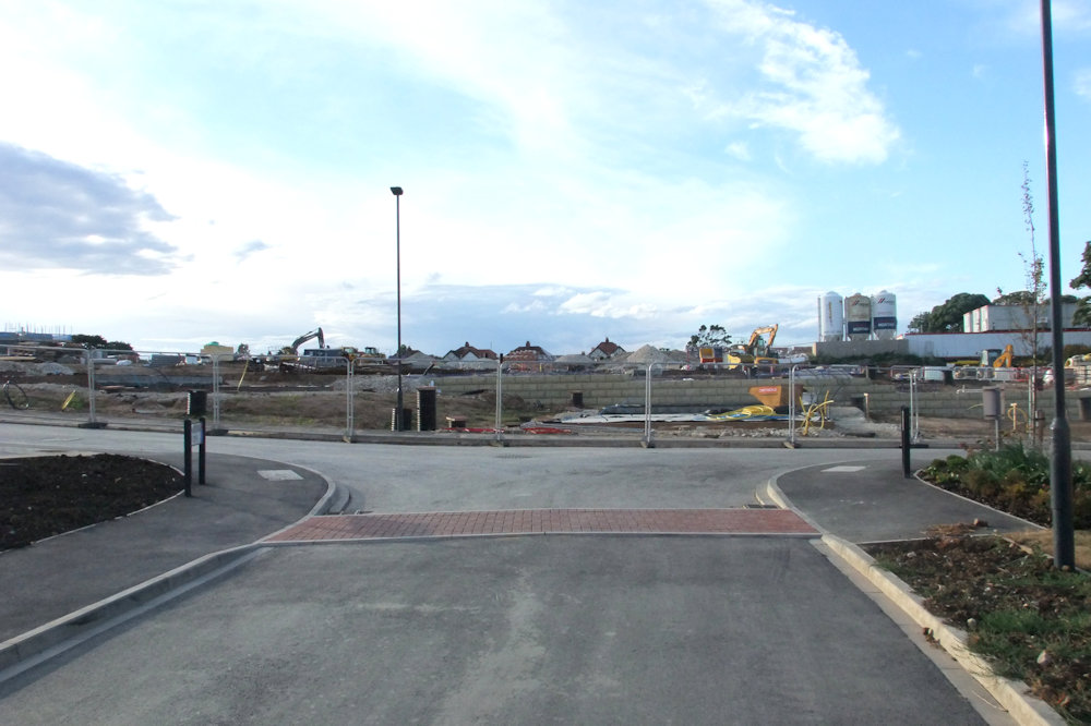
The framework for the new Aldi store is taking shape
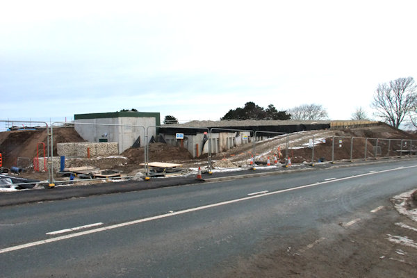
A
second frame-work was started nearer to
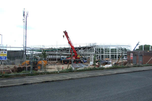
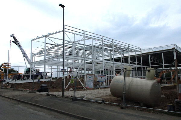
Above from left: Aldi store frame-work taking shape as seen from the main road; A second frame-work started possibly for the new M & S store as viewed from Fairfield Way

Above from left: The front of the
buildings from


Above from left: The front of the
site - taking shape; The side of the site from

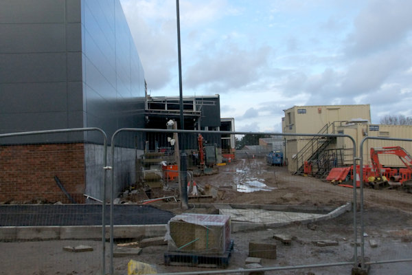
Above: Aldi open and empty unit next door
The
end of 2017 saw the closure of a couple of long-established
Above from left:
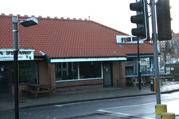
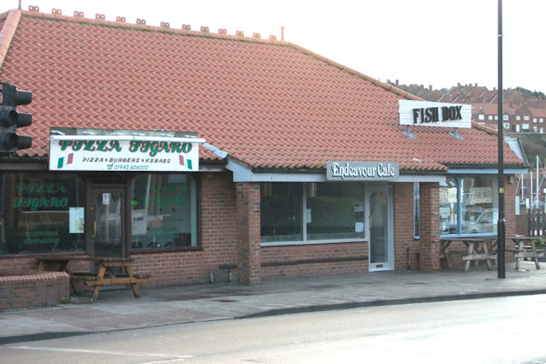
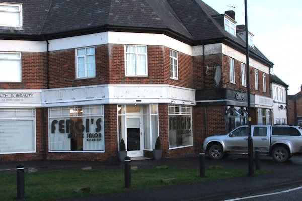
Cabin Cafe closed with fascia boarding removed; Endeavour Cafe opens in former Cabin Cafe premises; Fergi's Salon opens at 8 The Parade